Walkerville, South Africa
| Walkerville | |
|---|---|
 | |
 Walkerville  Walkerville Walkerville (South Africa)  Walkerville Walkerville (Africa) | |
| Coordinates: 26°25′12″S 27°57′25″E / 26.420°S 27.957°ECoordinates: 26°25′12″S 27°57′25″E / 26.420°S 27.957°E | |
| Country | South Africa |
| Province | Gauteng |
| District | Sedibeng |
| Municipality | Midvaal |
| Area[1] | |
| • Total | 97.07 km2 (37.48 sq mi) |
| Population (2011)[1] | |
| • Total | 9,173 |
| • Density | 94/km2 (240/sq mi) |
| Racial makeup (2011)[1] | |
| • Black African | 53.2% |
| • Coloured | 5.6% |
| • Indian/Asian | 0.9% |
| • White | 39.4% |
| • Other | 0.9% |
| First languages (2011)[1] | |
| • English | 34.5% |
| • Afrikaans | 18.2% |
| • Zulu | 14.9% |
| • Sotho | 13.0% |
| • Other | 19.4% |
| Time zone | UTC+2 (SAST) |
| Postal code (street) | 1961 |
| PO box | 1876 |
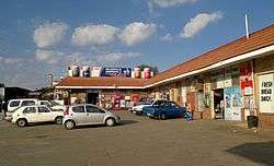
Walkerville is a village in Gauteng, South Africa, about 30 km (20 mi) south of Johannesburg.
References
- 1 2 3 4 "Main Place Walkerville". Census 2011.
External links
Municipalities and communities of Sedibeng District Municipality, Gauteng | ||
|---|---|---|
District seat: Vereeniging | ||
| Emfuleni | .svg.png) | |
| Midvaal | ||
This article is issued from
Wikipedia.
The text is licensed under Creative Commons - Attribution - Sharealike.
Additional terms may apply for the media files.