Walkers Corner, Missouri
| Walkers Corner, Missouri | |
|---|---|
| Unincorporated community | |
 Walkers Corner  Walkers Corner | |
| Coordinates: 38°10′57″N 93°05′48″W / 38.18250°N 93.09667°WCoordinates: 38°10′57″N 93°05′48″W / 38.18250°N 93.09667°W | |
| Country | United States |
| State | Missouri |
| County | Benton |
| Elevation | 886 ft (270 m) |
| Time zone | UTC-6 (Central (CST)) |
| • Summer (DST) | UTC-5 (CDT) |
| Area code(s) | 660 |
| GNIS feature ID | 741344[1] |
Walkers Corner is an unincorporated community in Benton County, Missouri, United States. Walkers Corner is located at the junction of Supplemental Routes DD and FF 16.1 miles (25.9 km) east-southeast of Warsaw.[2]
References
- ↑ "Walkers Corner". Geographic Names Information System. United States Geological Survey.
- ↑ Benton County General Highway Map (PDF) (Map). Missouri Department of Transportation. 2005. Retrieved May 26, 2012.
Municipalities and communities of Benton County, Missouri, United States | ||
|---|---|---|
| Cities | 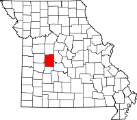 | |
| Village | ||
| Townships | ||
| Unincorporated communities |
| |
| Former settlements | ||
| Footnotes | ‡This populated place also has portions in an adjacent county or counties | |
This article is issued from
Wikipedia.
The text is licensed under Creative Commons - Attribution - Sharealike.
Additional terms may apply for the media files.