Waidhofen, Bavaria
| Waidhofen | ||
|---|---|---|
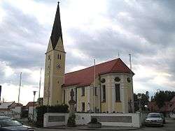 Roman Catholic parish church | ||
| ||
 Waidhofen Location of Waidhofen within Neuburg-Schrobenhausen district  | ||
| Coordinates: 48°34′45″N 11°20′20″E / 48.57917°N 11.33889°ECoordinates: 48°34′45″N 11°20′20″E / 48.57917°N 11.33889°E | ||
| Country | Germany | |
| State | Bavaria | |
| Admin. region | Oberbayern | |
| District | Neuburg-Schrobenhausen | |
| Municipal assoc. | Schrobenhausen | |
| Government | ||
| • Mayor | Josef Lechner | |
| Area | ||
| • Total | 27.32 km2 (10.55 sq mi) | |
| Elevation | 404 m (1,325 ft) | |
| Population (2017-12-31)[1] | ||
| • Total | 2,259 | |
| • Density | 83/km2 (210/sq mi) | |
| Time zone | CET/CEST (UTC+1/+2) | |
| Postal codes | 86579 | |
| Dialling codes | 08443 | |
| Vehicle registration | ND | |
| Website | www.waidhofen.de | |

Waidhofen is a municipality in the district of Neuburg-Schrobenhausen in Bavaria in Germany.
The former farmstead Hinterkaifeck, site of six murders in 1922, falls within this municipality and within the formerly existing municipality of Wangen.
References
- ↑ "Fortschreibung des Bevölkerungsstandes". Bayerisches Landesamt für Statistik und Datenverarbeitung (in German). September 2018.
Towns and municipalities in Neuburg-Schrobenhausen | ||
|---|---|---|
This article is issued from
Wikipedia.
The text is licensed under Creative Commons - Attribution - Sharealike.
Additional terms may apply for the media files.