Würm
| Würm | |
|---|---|
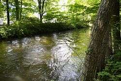 The Würm in Pasing. | |
| Country | Germany |
| States | Bavaria |
| Physical characteristics | |
| River mouth |
Amper 48°08′38″N 11°27′15″E / 48.14389°N 11.45417°ECoordinates: 48°08′38″N 11°27′15″E / 48.14389°N 11.45417°E |
| Length | 39.8 km (24.7 mi) [1] |
| Basin features | |
| Progression | Amper→ Isar→ Danube→ Black Sea |
| Basin size | 429 km2 (166 sq mi) [1] |
The Würm is a river in Bavaria, Germany, right tributary of the Amper. The length of the river is 39.8 kilometres (24.7 mi), or 76.3 kilometres (47.4 mi) including the Steinbach, the main feed of Lake Starnberg. It drains the overflow from Lake Starnberg and flows swiftly through the villages of Gauting, Krailling, Planegg, Gräfelfing and Lochham as well as part of Munich (in the borough of Pasing) before joining, near Dachau, the Amper, which soon afterwards flows into the Isar and eventually flowing into the Danube. Although the Würm is not a very large river, it is well known as it gave its name to the Würm glaciation.
A small man-made channel extracts water from the river at Pasing to feed the water features at Nymphenburg Palace, before flowing on to join the Isar at the public parc Englischer Garten in Munich.
References
- 1 2 Complete table of the Bavarian Waterbody Register by the Bavarian State Office for the Environment (xls, 10.3 MB)
| Wikimedia Commons has media related to Würm (Bavaria). |