Vrhovo pri Šentlovrencu
| Vrhovo pri Šentlovrencu | |
|---|---|
 | |
 Vrhovo pri Šentlovrencu Location in Slovenia | |
| Coordinates: 45°56′17.38″N 14°55′40.91″E / 45.9381611°N 14.9280306°ECoordinates: 45°56′17.38″N 14°55′40.91″E / 45.9381611°N 14.9280306°E | |
| Country |
|
| Traditional region | Lower Carniola |
| Statistical region | Southeast Slovenia |
| Municipality | Trebnje |
| Area | |
| • Total | 0.51 km2 (0.20 sq mi) |
| Elevation | 310.5 m (1,018.7 ft) |
| Population (2002) | |
| • Total | 38 |
| [1] | |
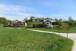
Vrhovo pri Šentlovrencu (pronounced [ʋəɾˈxɔːʋɔ pɾi ʃɛnˈtloːu̯ɾɛntsu] or [ʋəɾˈxɔːʋɔ pɾi ʃənˈtloːu̯ɾɛntsu]; German: Werchow[2]) is a small settlement in the Municipality of Trebnje in eastern Slovenia. It lies on the left bank of the Temenica River west of Šentlovrenc. The area is part of the historical region of Lower Carniola. The municipality is now included in the Southeast Slovenia Statistical Region.[3]
Name
The name of the settlement was changed from Vrhovo to Vrhovo pri Šentlovrencu in 1953.[4] In the past the German name was Werchow.[2]
References
- ↑ Statistical Office of the Republic of Slovenia
- 1 2 Leksikon občin kraljestev in dežel zastopanih v državnem zboru, vol. 6: Kranjsko. 1906. Vienna: C. Kr. Dvorna in Državna Tiskarna, p. 102.
- ↑ Trebnje municipal site
- ↑ Spremembe naselij 1948–95. 1996. Database. Ljubljana: Geografski inštitut ZRC SAZU, DZS.
External links

This article is issued from
Wikipedia.
The text is licensed under Creative Commons - Attribution - Sharealike.
Additional terms may apply for the media files.