Vranica
| Vranica | |
|---|---|
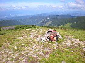 Vranica, Nadkrstac, summit view. | |
| Highest point | |
| Elevation | 2,110 m (6,920 ft) |
| Coordinates | 43°57.400′N 17°42.993′E / 43.956667°N 17.716550°ECoordinates: 43°57.400′N 17°42.993′E / 43.956667°N 17.716550°E |
| Geography | |
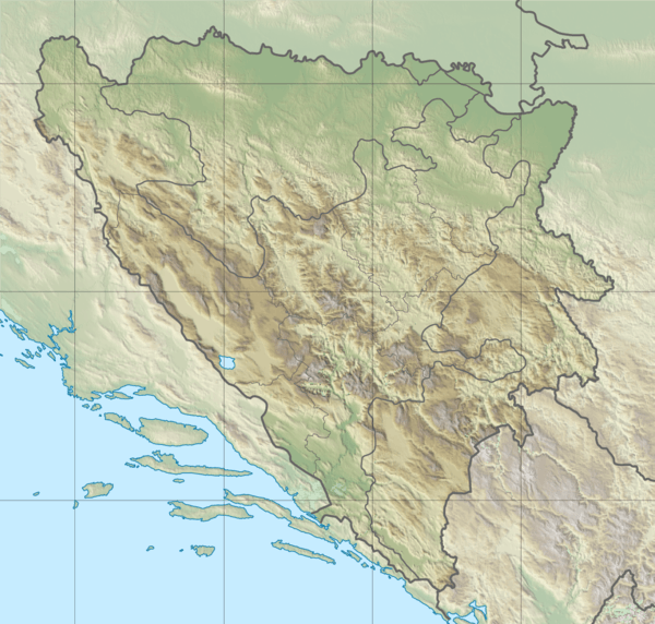 Vranica Location in Bosnia | |
| Location |
|
Vranica is a mountain range in the Dinaric Alps of central Bosnia and Herzegovina, located between the town of Gornji Vakuf in the west and the town of Fojnica in the east, within the territory of the Federation. The highest peak is Nadkrstac at 2,110 metres (6,920 ft).[1] Geologically, the Vranica range is part of the Dinaric Alps and formed largely of secondary and tertiary sedimentary rock, mostly limestone. Notable peaks are Nadkrstac (2110 m.), Locika (2106 m.), Rosinj (2059 m.) and Scit (1949 m.). Thick shrubs of Pinus Mugo replace mixed forest -mostly beech- above 1400 m. The typical karst characteristics of the nearby Herzegovina mountains is relatively absent in Vranica, which has relatively abundant water sources. Streams that source from these mountains are the Dragača in the east, the Vrbas in the west.
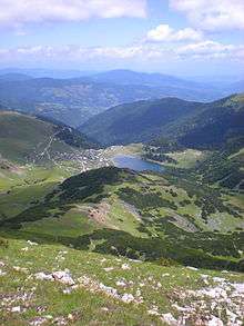
Prokoško Lake
Just east of its main summit, at 1660 m altitude is a beautiful glacial lake called Prokoško Jezero located. This lake was once known as a habitat for a unique amphibian endemic variant of the Triton Salamander (Ichthyosaura alpestris reiseri). On the northern shore one finds a settlement of typical wooden shepherd huts which unfortunately in recent years has grown oversized with illegal recreational sheds that threaten the vulnerable eco-system.[2] Prokoško Jezero received a protected status in 2005 based on IUCN criteria, when it was declared a Monument of Nature by the BiH authorities.[3] Despite these protective measures, it is not clear whether pollution connected to over-recreation will have become entirely fatal for the salamander.
Hiking
The Vranica mountains were only on the edges affected by combat during the 1992-1995 conflict. The central main ridge remained largely spared from warfare and the mine risk is therefore minimal. Also for that reason Vranica is an attractive destination for hikers, mountain bikers and tour skiers.[4] A rough unpaved mountain road leads from Fojnica to Prokoško Jezero. A mountain hut -Rosinj P.D.- is located on the west side of the main ridge at 1780 m.[5]
See also
References
- ↑ "Statistical Yearbook of the Federation of Bosnia and Herzegovina" (PDF). Federation of Bosnia and Herzegovina, Federal Office of Statistics. 2009. p. 28. Archived from the original (PDF) on 2011-06-29. Retrieved 2010-03-07.
- ↑ Balkan Trust for Democracy Bulletin – Fall 2007 September 18, 2007 http://www.gmfus.org/archives/balkan-trust-for-democracy-bulletin-fall-2007
- ↑ Đug, S. and Drešković,Revija za geografijo - Journal for Geography, 7-1, 2012, 69-80 NATURE PROTECTION IN BOSNIA AND HERZEGOVINA: STATE AND PERSPECTIVES Đug, S. and Drešković, N. 2005: Management plan for Nature monument Prokosko lake. NGO Greenway Sarajevo. Sarajevo. In Bosnian.
- ↑ Matias Gomez: Forgotten Beauty, a hiker's guide to BiH's 2000 meter peaks, page 21 to 28, ISBN 978-9958-630-59-0, Buybook, Sarajevo, 2005
- ↑ http://www.summitpost.org/vranica/152217
External links
43°57′05″N 17°44′59″E / 43.95139°N 17.74972°E
| Wikimedia Commons has media related to Vranica. |