Volyňka
| Volyňka | |
|---|---|
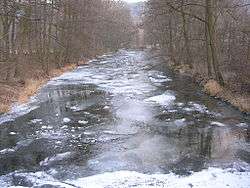 Volyňka in Malenice | |
| Country | Czech Republic |
| Physical characteristics | |
| Main source | Šumava |
| River mouth |
Otava 49°15′31″N 13°54′15″E / 49.2586°N 13.9043°ECoordinates: 49°15′31″N 13°54′15″E / 49.2586°N 13.9043°E |
| Length | 46.1 km (28.6 mi) |
| Discharge |
|
| Basin features | |
| Progression | Otava→ Vltava→ Elbe→ North Sea |
| Basin size | 426.66 km2 (164.73 sq mi) |
Volyňka is a river in the Czech Republic in the South Bohemian Region rising on the hill called Světlá hora and flowing northeast to the city of Strakonice, where it merges with Otava River. Volyňka flows through towns such as Vimperk, Volyně, Strakonice and villages like Lčovice and Čkyně.[1] It is 46.1 kilometres (28.6 mi) long, and its basin area is 427 square kilometres (165 sq mi).[2] Four ancient settlements, dated 600–500 BC, were found around the river: Věnec near Lcovice, Němětice, Libětice and Třebohostice.[3]
References
| Wikimedia Commons has media related to Volyňka. |
- ↑ "JIŽNÍ ČECHY A ŠUMAVA". www.jiznicechy.org (in Czech). Retrieved 9 July 2017.
- ↑ "Charakteristiky toků a povodí ČR - Volyňka" (in Czech). VÚV TGM. Retrieved 2018-05-08.
- ↑ "Zálezly, hradiště Věnec - archeolog.cz". www.archeolog.cz (in Czech). Retrieved 9 July 2017.
External links
This article is issued from
Wikipedia.
The text is licensed under Creative Commons - Attribution - Sharealike.
Additional terms may apply for the media files.