Villiers-le-Sec, Calvados
| Villiers-le-Sec | ||
|---|---|---|
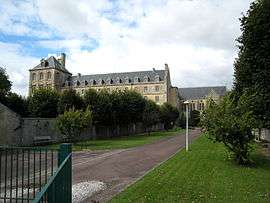 Former seminary | ||
| ||
 Villiers-le-Sec Location within Normandy region  Villiers-le-Sec | ||
| Coordinates: 49°17′30″N 0°33′50″W / 49.2917°N 0.5639°WCoordinates: 49°17′30″N 0°33′50″W / 49.2917°N 0.5639°W | ||
| Country | France | |
| Region | Normandy | |
| Department | Calvados | |
| Arrondissement | Bayeux | |
| Canton | Bretteville-l'Orgueilleuse | |
| Area1 | 2.71 km2 (1.05 sq mi) | |
| Population (2009)2 | 283 | |
| • Density | 100/km2 (270/sq mi) | |
| Time zone | UTC+1 (CET) | |
| • Summer (DST) | UTC+2 (CEST) | |
| INSEE/Postal code | 14757 /14480 | |
| Elevation | 11–66 m (36–217 ft) | |
|
1 French Land Register data, which excludes lakes, ponds, glaciers > 1 km2 (0.386 sq mi or 247 acres) and river estuaries. 2 Population without double counting: residents of multiple communes (e.g., students and military personnel) only counted once. | ||
.svg.png)
Villiers-le-Sec is a former commune in the Calvados department in the Normandy region in northwestern France. On 1 January 2017, it was merged into the new commune Creully sur Seulles.[1]
Population
| Historical population | ||
|---|---|---|
| Year | Pop. | ±% |
| 1962 | 419 | — |
| 1968 | 401 | −4.3% |
| 1975 | 295 | −26.4% |
| 1982 | 356 | +20.7% |
| 1990 | 338 | −5.1% |
| 1999 | 300 | −11.2% |
| 2009 | 283 | −5.7% |
See also
References
- ↑ Arrêté préfectoral 8 September 2016 (in French)
| Wikimedia Commons has media related to Villiers-le-Sec (Calvados). |
This article is issued from
Wikipedia.
The text is licensed under Creative Commons - Attribution - Sharealike.
Additional terms may apply for the media files.