Villemaur-sur-Vanne
| Villemaur-sur-Vanne | ||
|---|---|---|
 | ||
| ||
 Villemaur-sur-Vanne Location within Grand Est region  Villemaur-sur-Vanne | ||
| Coordinates: 48°15′26″N 3°43′45″E / 48.2572°N 3.7292°ECoordinates: 48°15′26″N 3°43′45″E / 48.2572°N 3.7292°E | ||
| Country | France | |
| Region | Grand Est | |
| Department | Aube | |
| Arrondissement | Troyes | |
| Canton | Aix-en-Othe | |
| Area1 | 19.65 km2 (7.59 sq mi) | |
| Population (2012)2 | 502 | |
| • Density | 26/km2 (66/sq mi) | |
| Time zone | UTC+1 (CET) | |
| • Summer (DST) | UTC+2 (CEST) | |
| INSEE/Postal code | 10415 /10190 | |
| Elevation |
120–232 m (394–761 ft) (avg. 138 m or 453 ft) | |
|
1 French Land Register data, which excludes lakes, ponds, glaciers > 1 km2 (0.386 sq mi or 247 acres) and river estuaries. 2 Population without double counting: residents of multiple communes (e.g., students and military personnel) only counted once. | ||

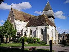
Villemaur-sur-Vanne is a former commune in the Aube department in north-central France. On 1 January 2016, it was merged into the new commune Aix-Villemaur-Pâlis.[1]
Population
| Historical population | ||
|---|---|---|
| Year | Pop. | ±% |
| 1962 | 470 | — |
| 1968 | 488 | +3.8% |
| 1975 | 442 | −9.4% |
| 1982 | 384 | −13.1% |
| 1990 | 381 | −0.8% |
| 1999 | 424 | +11.3% |
| 2008 | 490 | +15.6% |
| 2012 | 502 | +2.4% |
See also
References
- ↑ Arrêté préfectoral 15 December 2015 (in French)
| Wikimedia Commons has media related to Villemaur-sur-Vanne. |
This article is issued from
Wikipedia.
The text is licensed under Creative Commons - Attribution - Sharealike.
Additional terms may apply for the media files.