Villa Sara
| Villa Sara | |
|---|---|
| Suburb of Treinta y Tres | |
 Villa Sara Location in Uruguay | |
| Coordinates: 33°15′10″S 54°24′50″W / 33.25278°S 54.41389°WCoordinates: 33°15′10″S 54°24′50″W / 33.25278°S 54.41389°W | |
| Country |
|
| Department | Treinta y Tres Department |
| Population (2011) | |
| • Total | 1,199 |
| Time zone | UTC -3 |
| Postal code | 33000 |
| Dial plan | +598 445 (+5 digits) |
Villa Sara is a suburb of Treinta y Tres, capital city of the Treinta y Tres Department in eastern Uruguay.
Location
The suburb is located on Km. 280 of Route 8 and on its intersection with Route 19. The river Río Olimar Grande and the "Park of Río Olimar" to its northeast, separate it from the city.
Population
In 2011 Villa Sara had a population of 1,199.[1]
| Year | Population |
|---|---|
| 1963 | 152 |
| 1975 | 635 |
| 1985 | 635 |
| 1996 | 972 |
| 2004 | 1,056 |
| 2011 | 1,199 |
Source: Instituto Nacional de Estadística de Uruguay[2]
References
- ↑ "Censos 2011 Cuadros Trenta y Tres". INE. 2012. Archived from the original on 10 October 2012. Retrieved 25 August 2012.
- ↑ "1963–1996 Statistics / V" (DOC). Instituto Nacional de Estadística de Uruguay. 2004. Retrieved 29 June 2011.
External links
Capital: Treinta y Tres | ||
| Towns and villages | 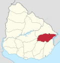 | |
| Sights | ||
This article is issued from
Wikipedia.
The text is licensed under Creative Commons - Attribution - Sharealike.
Additional terms may apply for the media files.