Villa Dolores
| Villa Dolores | |
|---|---|
| City | |
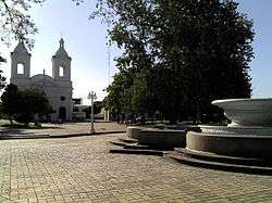 | |
 Villa Dolores Location of Villa Dolores in Argentina | |
| Coordinates: 31°56′S 65°12′W / 31.933°S 65.200°WCoordinates: 31°56′S 65°12′W / 31.933°S 65.200°W | |
| Country |
|
| Province |
|
| Department | San Javier |
| Founded | April 21, 1853 |
| Elevation | 584 m (1,916 ft) |
| Population (2010 census) | |
| • Total | 29,854 |
| Demonym(s) | Dolorense |
| Time zone | UTC-3 (ART) |
| CPA base | X5870 |
| Dialing code | +54 3544 |
| Website | Official website |
Villa Dolores is a city in the province of Córdoba, Argentina, located in the southwestern side of the province. It has a population of 29,854 inhabitants.
Although it is one of the smallest cities in Córdoba, many other provinces rely on Villa Dolores for its major export in potatoes. Wine consumption is also a large trait in this town having its own import route from the capital city of wine in Argentina, Mendoza.
Climate
| Climate data for Villa Dolores (1981–2010, extremes 1961–present) | |||||||||||||
|---|---|---|---|---|---|---|---|---|---|---|---|---|---|
| Month | Jan | Feb | Mar | Apr | May | Jun | Jul | Aug | Sep | Oct | Nov | Dec | Year |
| Record high °C (°F) | 42.9 (109.2) |
41.2 (106.2) |
38.2 (100.8) |
36.0 (96.8) |
31.1 (88) |
30.1 (86.2) |
33.0 (91.4) |
37.0 (98.6) |
39.5 (103.1) |
42.0 (107.6) |
41.2 (106.2) |
43.1 (109.6) |
43.1 (109.6) |
| Average high °C (°F) | 32.3 (90.1) |
31.0 (87.8) |
28.8 (83.8) |
24.9 (76.8) |
21.1 (70) |
18.3 (64.9) |
18.2 (64.8) |
21.3 (70.3) |
24.0 (75.2) |
28.1 (82.6) |
30.4 (86.7) |
31.9 (89.4) |
25.9 (78.6) |
| Daily mean °C (°F) | 25.1 (77.2) |
23.7 (74.7) |
21.8 (71.2) |
17.7 (63.9) |
13.8 (56.8) |
10.7 (51.3) |
10.1 (50.2) |
12.9 (55.2) |
15.8 (60.4) |
20.3 (68.5) |
22.8 (73) |
24.6 (76.3) |
18.3 (64.9) |
| Average low °C (°F) | 18.1 (64.6) |
17.1 (62.8) |
16.0 (60.8) |
12.2 (54) |
8.7 (47.7) |
5.6 (42.1) |
4.5 (40.1) |
6.6 (43.9) |
8.8 (47.8) |
12.8 (55) |
15.2 (59.4) |
17.3 (63.1) |
11.9 (53.4) |
| Record low °C (°F) | 5.5 (41.9) |
4.9 (40.8) |
2.8 (37) |
−4.5 (23.9) |
−5.1 (22.8) |
−6.7 (19.9) |
−8.9 (16) |
−10.0 (14) |
−3.9 (25) |
−0.2 (31.6) |
−1.0 (30.2) |
5.7 (42.3) |
−10.0 (14) |
| Average precipitation mm (inches) | 121.1 (4.768) |
102.2 (4.024) |
94.4 (3.717) |
42.4 (1.669) |
17.6 (0.693) |
4.7 (0.185) |
13.2 (0.52) |
6.1 (0.24) |
22.9 (0.902) |
35.1 (1.382) |
75.1 (2.957) |
113.3 (4.461) |
648.1 (25.516) |
| Average precipitation days (≥ 0.1 mm) | 10.5 | 9.1 | 8.6 | 5.5 | 3.7 | 1.8 | 2.5 | 1.6 | 3.7 | 4.8 | 8.0 | 10.5 | 70.3 |
| Average relative humidity (%) | 61.1 | 64.9 | 70.3 | 71.4 | 72.2 | 70.5 | 64.3 | 54.4 | 50.5 | 50.7 | 53.0 | 57.9 | 61.8 |
| Mean monthly sunshine hours | 288.3 | 276.9 | 241.8 | 228.0 | 201.5 | 180.0 | 201.5 | 238.7 | 234.0 | 260.4 | 282.0 | 272.8 | 2,905.9 |
| Percent possible sunshine | 67 | 73 | 63 | 67 | 62 | 59 | 62 | 70 | 65 | 66 | 68 | 62 | 65 |
| Source #1: Servicio Meteorológico Nacional[1][2] | |||||||||||||
| Source #2: UNLP (sun only)[3] | |||||||||||||
Tourism
Tourism in Villa Dolores peaks during the high season (January - February). Villa Dolores is known for its peaceful environment and views of the Cordoba mountain range. It is also known for its hidden rivers that run freshwater streams from the mountain tops, including the stream known as "La Piedra Pintada".
References
- ↑ "Estadísticas Climatológicas Normales - período 1981-2010" (in Spanish). Servicio Meteorológico Nacional. Retrieved January 20, 2018.
- ↑ "Clima en la Argentina: Guia Climática por Villa Dolores Aero". Caracterización: Estadísticas de largo plazo (in Spanish). Servicio Meteorológico Nacional. Archived from the original on 4 September 2017. Retrieved 5 October 2017.
- ↑ "Datos bioclimáticos de 173 localidades argentinas". Atlas Bioclimáticos (in Spanish). Universidad Nacional de La Plata. Retrieved June 15, 2015.
External links
| Wikimedia Commons has media related to Villa Dolores, Córdoba. |
Municipal information: Municipal Affairs Federal Institute (IFAM), Municipal Affairs Secretariat, Ministry of Interior, Argentina. (in Spanish)
- (in Spanish) Municipal website
| Capital city | |
|---|---|
| Regional Cities | |