Vida, Missouri
Vida is an unincorporated community in Phelps County, Missouri, United States. Vida is approximately seven miles south of Rolla, Missouri near the junction of US Highway 63 and Missouri State Highway W.[1] Vida is located at latitude 37.857 and longitude -91.8 and is at an elevation of 1033 feet above sea level.[2] Vida can be found on Phelps County plat maps in Section 10, Township 36 N, Range 9 W.[3]
A post office called Vida was established in 1898, and remained in operation until 1977.[4] An early postmaster gave the community the name of a local girl in the neighborhood.[5]
Vida has not been included in past U.S. Census counts, so there is no population information for this community.[6] However, best local estimates place the population of Vida at around one or two hundred people. Vida does not have a dedicated U.S. post office location, and is instead served by the Newburg, Missouri post office.[7]
A local destination is the low water bridge where County Road 7460 crosses the Little Piney Creek. It is a Missouri Department of Conservation Blue Ribbon Trout Area, with a self-sustaining population of rainbow trout. A Missouri fishing permit is required and a daily limit of one trout of 18 inches or greater length.[8]
References
- ↑ "Phelps County, Missouri 1904 Map". Mygenealogyhound.com. Retrieved 2014-05-14.
- ↑ "Vida Populated Place Profile / Phelps County, Missouri Data". Missouri.hometownlocator.com. Retrieved 2014-05-14.
- ↑ "A Directory of Towns, Villages, and Hamlets of Missouri". Thelibrary.org. Retrieved 2014-05-14.
- ↑ "Post Offices". Jim Forte Postal History. Retrieved 5 December 2016.
- ↑ "Phelps County Place Names, 1928–1945". The State Historical Society of Missouri. Archived from the original on June 24, 2016. Retrieved December 5, 2016.
- ↑ "Vida (Phelps County, Missouri [MO]): Census Information". 37.8570; -91.7996: Roadsidethoughts.com. 2014-05-06. Retrieved 2014-05-14.
- ↑ "U.S. Post Office Newburg MO, Hours & Locations". Forlocations.com. Retrieved 2014-05-14.
- ↑ "Trout Areas | Missouri Department of Conservation". Mdc.mo.gov. Retrieved 2014-05-14.
Municipalities and communities of Phelps County, Missouri, United States | ||
|---|---|---|
| Cities | 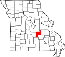 | |
| Townships | ||
| Unincorporated communities | ||
| Ghost towns | ||
Coordinates: 37°51′25″N 91°47′59″W / 37.85694°N 91.79972°W