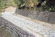
Via Popilia
The Via Popilia is the name of two different ancient Roman roads begun in the consulship of Publius Popilius Laenas.
The first road was an extension of the Via Flaminia from Ariminum around the north of the Adriatic through the region that later became Venice. The name of this road continues as a street name in modern Rimini, which, as Ariminum, was the junction point between the Via Flaminia from Rome, the Via Aemilia along the edge of the Po valley, and the northern Via Popilia. It ran along the shore strip (Lido) from Ariminum to Ravenna (33 miles (53 km)), where it was usual in imperial times for travellers to take ship and go by canal to Altinum, and there resume their journey by road.[1]
The second Via Popilia ran from the Via Appia at Capua to Rhegium on the Straits of Messina.[1] An archaeological discovery of part of its itinerarium engraved on stone (The Polla Tablet) brought it more fully into the light of history. It ran a distance of 321 miles (517 km) from the right along the length of the Italian peninsula, and the main road through the interior of the country, not along the coast.[1]
Roman bridges
There are the remains of at least one Roman bridge along the road, the Ponte sul Savuto.
See also
References
- 1 2 3

External links
| Wikimedia Commons has media related to Via Popilia. |