Vesela Hora, Luhansk Oblast
| Vesela Hora Весела Гора | |
|---|---|
| Village | |
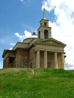 Local church | |
 Vesela Hora Location of Vesela Hora within Ukraine | |
| Coordinates: 48°42′42″N 39°14′59″E / 48.711667°N 39.249722°ECoordinates: 48°42′42″N 39°14′59″E / 48.711667°N 39.249722°E | |
| Country | Ukraine |
| Province | Luhansk Oblast |
| District | Slovianoserbsk Raion |
| Founded | 1765 |
| Area | |
| • Total | 1.657 km2 (0.640 sq mi) |
| Elevation | 52 m (171 ft) |
| Population (2001 census) | |
| • Total | 1,197 |
| • Density | 720/km2 (1,900/sq mi) |
| Time zone | UTC+2 (EET) |
| • Summer (DST) | UTC+3 (EEST) |
| Postal code | 93730 |
| Area code | +380 6473 |
Vesela Hora (Ukrainian: Весела Гора; Russian: Весёлая Гора) is a village in Slovianoserbsk Raion (district) in Luhansk Oblast of eastern Ukraine, at about 30 km NNW from the centre of Luhansk, on the right bank of the Siverskyi Donets river.
The settlement was taken under control of pro-Russian forces during the War in Donbass, that started in 2014.[1]
Demographics
In 2001 the settlement had 1197 inhabitants. Native language as of the Ukrainian Census of 2001:[2]
- Ukrainian — 26.07%
- Russian — 73.93%
References
- ↑ "Кабмин назвал города Донбасса, подконтрольные сепаратистам" (in Russian). korrespondent.net. Retrieved 2015-10-08.
- ↑ Розподіл населення за рідною мовою на ukrcensus.gov.ua
This article is issued from
Wikipedia.
The text is licensed under Creative Commons - Attribution - Sharealike.
Additional terms may apply for the media files.