Vendeuvre-du-Poitou
| Vendeuvre-du-Poitou | |
|---|---|
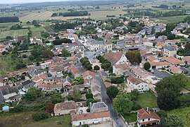 An aerial view of Vendeuvre-du-Poitou | |
 Vendeuvre-du-Poitou Location within Nouvelle-Aquitaine region  Vendeuvre-du-Poitou | |
| Coordinates: 46°44′11″N 0°18′37″E / 46.7364°N 0.3103°ECoordinates: 46°44′11″N 0°18′37″E / 46.7364°N 0.3103°E | |
| Country | France |
| Region | Nouvelle-Aquitaine |
| Department | Vienne |
| Arrondissement | Poitiers |
| Canton | Jaunay-Clan |
| Area1 | 41.62 km2 (16.07 sq mi) |
| Population (2006)2 | 2,798 |
| • Density | 67/km2 (170/sq mi) |
| Time zone | UTC+1 (CET) |
| • Summer (DST) | UTC+2 (CEST) |
| INSEE/Postal code | 86281 /86380 |
| Elevation |
69–158 m (226–518 ft) (avg. 100 m or 330 ft) |
|
1 French Land Register data, which excludes lakes, ponds, glaciers > 1 km2 (0.386 sq mi or 247 acres) and river estuaries. 2 Population without double counting: residents of multiple communes (e.g., students and military personnel) only counted once. | |
Vendeuvre-du-Poitou is a former commune in the Vienne department in the Nouvelle-Aquitaine region in western France. On 1 January 2017, it was merged into the new commune Saint Martin la Pallu.[1]
See also
References
- ↑ Arrêté préfectoral 19 July 2016 (in French)
| Wikimedia Commons has media related to Vendeuvre-du-Poitou. |
| Authority control |
|---|
This article is issued from
Wikipedia.
The text is licensed under Creative Commons - Attribution - Sharealike.
Additional terms may apply for the media files.