Vatne, Rogaland
| Vatne | |
|---|---|
| Village | |
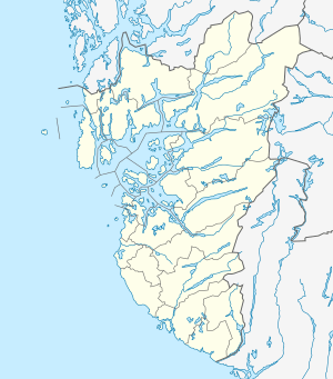 Vatne Location in Rogaland county  Vatne Vatne (Norway) | |
| Coordinates: 58°51′22″N 05°47′13″E / 58.85611°N 5.78694°ECoordinates: 58°51′22″N 05°47′13″E / 58.85611°N 5.78694°E | |
| Country | Norway |
| Region | Western Norway |
| County | Rogaland |
| District | Jæren |
| Municipality | Sandnes |
| Area[1] | |
| • Total | 0.5 km2 (0.2 sq mi) |
| Elevation[2] | 38 m (125 ft) |
| Population (2015)[1] | |
| • Total | 936 |
| • Density | 1,872/km2 (4,850/sq mi) |
| Time zone | UTC+01:00 (CET) |
| • Summer (DST) | UTC+02:00 (CEST) |
| Post Code | 4309 Sandnes |
Vatne is a village in Sandnes municipality in Rogaland county, Norway. The village lies in the borough of Hana, just about 3 kilometres (1.9 mi) northeast of the city centre of Sandnes. It is considered a part of the Stavanger/Sandnes urban area.[3] The 0.5-square-kilometre (120-acre) village has a population (2015) of 936, giving the village a population density of 1,872 inhabitants per square kilometre (4,850/sq mi).[1] The Vatneleiren military base is located in Vatne.
References
- 1 2 3 Statistisk sentralbyrå (1 January 2015). "Urban settlements. Population and area, by municipality".
- ↑ "Vatne, Sandnes (Rogaland)" (in Norwegian). yr.no. Retrieved 2016-03-31.
- ↑ Statistics Norway (1 January 2002). "Omitted settlements. 1 January 2002". Archived from the original on 2 April 2007.
This article is issued from
Wikipedia.
The text is licensed under Creative Commons - Attribution - Sharealike.
Additional terms may apply for the media files.