Vashafaru (Haa Alif Atoll)
| Vashafaru ވަށަފަރު | |
|---|---|
| Island | |
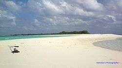 Vashafaru-thundi | |
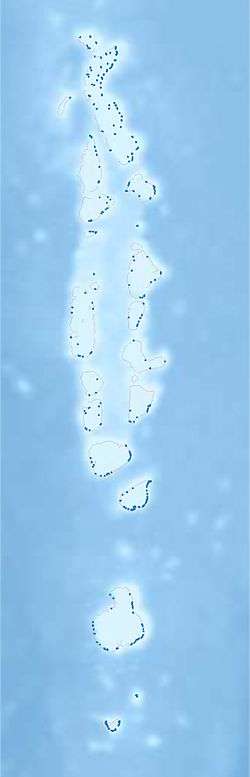 Vashafaru Location in Maldives | |
| Coordinates: 6°53′50″N 73°09′40″E / 6.89722°N 73.16111°ECoordinates: 6°53′50″N 73°09′40″E / 6.89722°N 73.16111°E | |
| Country | Maldives |
| Geographic atoll | Thiladhunmathi Atoll |
| Administrative atoll | Haa Alif Atoll |
| Distance to Malé | 303.46 km (188.56 mi) |
| Government | |
| • Council | Vashafaru Island Council |
| Dimensions | |
| • Length | 1.95 km (1.21 mi) |
| • Width | 0.22 km (0.14 mi) |
| Population (2014)[1] | |
| • Total | 449 (including foreigners) |
| Time zone | UTC+05:00 (MST) |
| Area code(s) | 650, 20 |
Vashafaru (Dhivehi: ވަށަފަރު) is one of the inhabited islands of Haa Alif Atoll and is geographically part of Thiladhummathi Atoll in the north of the Maldives. It is an island-level administrative constituency governed by the Vashafaru Island Council.
The island is famous for its long white sand spit- the Vashafaru-thundi. People of Vashafaru are skilled carpenters and boat-builders known throughout the Maldives.
Geography
The island is 303.46 km (189 mi; 164 nmi) north of the country's capital, Malé.[2]
Demography
| Historical population | ||
|---|---|---|
| Year | Pop. | ±% |
| 2006 | 471 | — |
| 2014 | 426 | −9.6% |
| 2006-2014: Census populations Source: [3] | ||
References
- ↑ "Table PP5: Resident Population by sex, nationality and locality (administrative islands), 2014" (PDF). Population and Households Census 2014. National Bureau of Statistics. p. 33. Retrieved 9 August 2018.
- ↑ "Coordinate Distance Calculator". Boulter.com. Retrieved 9 August 2018.
- ↑ "Table 3.3: Total Maldivian Population by Islands" (PDF). National Bureau of Statistics. Retrieved 9 August 2018.
External links
This article is issued from
Wikipedia.
The text is licensed under Creative Commons - Attribution - Sharealike.
Additional terms may apply for the media files.