Vas, Radlje ob Dravi
| Vas | |
|---|---|
 Vas Location in Slovenia | |
| Coordinates: 46°37′32.16″N 15°16′30.12″E / 46.6256000°N 15.2750333°ECoordinates: 46°37′32.16″N 15°16′30.12″E / 46.6256000°N 15.2750333°E | |
| Country |
|
| Traditional region | Styria |
| Statistical region | Carinthia |
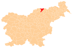
| Municipality | Radlje ob Dravi |
| Area | |
| • Total | 5.8 km2 (2.2 sq mi) |
| Elevation | 549.6 m (1,803.1 ft) |
| Population (2002) | |
| • Total | 430 |
| [1] | |
Vas (pronounced [ˈʋaːs]) is a settlement with a compact core on the left bank of the Drava River and extending into the hills towards Remšnik to the north in the Municipality of Radlje ob Dravi in Slovenia.[2]
References
External links
| Settlements | Administrative centre: Radlje ob Dravi
|  | ||||
|---|---|---|---|---|---|---|
| Landmarks |
| |||||
This article is issued from
Wikipedia.
The text is licensed under Creative Commons - Attribution - Sharealike.
Additional terms may apply for the media files.