Valserhorn
| Valserhorn | |
|---|---|
 from right: Valserhorn, Tällihorn 2820, Bärenhorn 2929 and Teischer 2688 (far left) from Selva Alp, above Vals | |
| Highest point | |
| Elevation | 2,886 m (9,469 ft) |
| Prominence | 236 m (774 ft) [1] |
| Parent peak | Bärenhorn |
| Coordinates | 46°33′37.1″N 9°12′29.6″E / 46.560306°N 9.208222°ECoordinates: 46°33′37.1″N 9°12′29.6″E / 46.560306°N 9.208222°E |
| Geography | |
 Valserhorn Location in Switzerland | |
| Location | Graubünden, Switzerland |
| Parent range | Lepontine Alps |
| Climbing | |
| Easiest route | The peak is accessible straight forward from Blauw Gufer Alp above Nufenen GR. |
The Valserhorn (also spelled Valser Horn) is a summit of the Lepontine Alps, situated between Vals and Nufenen in the canton of Graubünden in Switzerland, on territory of both municipalities. With a prominence of 236 meters it is commonly agreed to be an independent peak to higher Bärenhorn (2929m) one mile to its northeast.
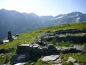
A popular hike starts at Zervreila, passes three remote lakes (Guraletschsee, Amperveilsee and Selvasee) and descends via Selva Alp to Vals. Vals is famous for its spa.[2]
References
- ↑ Retrieved from the Swisstopo topographic maps. The key col is the Lückli (2,650 m).
- ↑ Spa Switzerland: Vals, Graubünden
External links
This article is issued from
Wikipedia.
The text is licensed under Creative Commons - Attribution - Sharealike.
Additional terms may apply for the media files.