Vallière (river)
| Vallière | |
|---|---|
 | |
| Country | France |
| Physical characteristics | |
| Main source |
Revigny 400 m (1,300 ft) 46°37′25″N 05°36′28″E / 46.62361°N 5.60778°E |
| River mouth |
Solnan 177 m (581 ft) 46°37′09″N 05°13′22″E / 46.61917°N 5.22278°ECoordinates: 46°37′09″N 05°13′22″E / 46.61917°N 5.22278°E |
| Length | 50.8 km (31.6 mi) |
| Discharge |
|
| Basin features | |
| Progression | Solnan→ Seille→ Saône→ Rhône→ Mediterranean Sea |
| Basin size | 250 km2 (97 sq mi) |
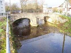
The Vallière (French: la Vallière) is a 50.8-kilometre (31.6 mi) long river in the Jura and Saône-et-Loire departments, in eastern France.[1] Its source is in the steephead valley of Revigny, in the Jura Mountains. It flows generally west. It is a right tributary of the Solnan, into which it flows between Bruailles and Louhans.
Departments and communes along its course
This list is ordered from source to mouth:
- Jura: Revigny, Conliège, Montaigu, Perrigny, Lons-le-Saunier, Montmorot, Courlans, Courlaoux, Condamine,
- Saône-et-Loire: Savigny-en-Revermont, Flacey-en-Bresse, Sagy, Saint-Martin-du-Mont, Bruailles, Louhans,
Notes
- This article is based on the equivalent article from the French Wikipedia, consulted on April 9th 2009.
References
This article is issued from
Wikipedia.
The text is licensed under Creative Commons - Attribution - Sharealike.
Additional terms may apply for the media files.