Valdemarsvik Municipality
| Valdemarsvik Municipality Valdemarsviks kommun | ||
|---|---|---|
| Municipality | ||
| ||
 | ||
| Country | Sweden | |
| County | Östergötland County | |
| Seat | Valdemarsvik | |
| Area[1] | ||
| • Total | 2,049.56 km2 (791.34 sq mi) | |
| • Land | 733.82 km2 (283.33 sq mi) | |
| • Water | 1,315.74 km2 (508.01 sq mi) | |
| Area as of 1 January 2014. | ||
| Population (31 December 2017)[2] | ||
| • Total | 7,920 | |
| • Density | 3.9/km2 (10/sq mi) | |
| Time zone | UTC+1 (CET) | |
| • Summer (DST) | UTC+2 (CEST) | |
| ISO 3166 code | SE | |
| Province | Östergötland and Småland | |
| Municipal code | 0563 | |
| Website | www.valdemarsvik.se | |

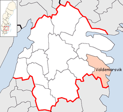
Valdemarsvik Municipality (Valdemarsviks kommun) is a municipality in Östergötland County in southeast Sweden. Its seat is located in the town of Valdemarsvik.
Valdemarsvik was originally a market town (köping) under the city of Söderköping. When the first local government acts came into force in Sweden in 1863 Valdemarsvik was not made a municipality of its own, but part of Ringarum. It was detached from Ringarum in 1914. The municipal reform of 1971 created the present municipality by reuniting Ringarum with Valdemarsvik and also adding Gryt and a part of the dissolved Tjust-Ed. The latter territory was transferred from Kalmar County.
Geographically, it is notable for an archipelago and a harbour.
Sights
The local church is from the 1870s, with extensive renovations in the early 20th century.
Notable natives
- Lena Ek, former member of the European Parliament and the Riksdag, lives in Valdemarsvik
- Nils Liedholm, professional soccer player, was born and raised in Valdemarsvik
Elections
Riksdag
These are the results of the Riksdag elections of Söderköping Municipality since the 1972 municipality reform. The results of the Sweden Democrats were not published by SCB between 1988 and 1998 at a municipal level to the party's small nationwide size at the time. "Turnout" denotes the percentage of the electorate casting a ballot, whereas "Votes" only denotes valid votes.
| Year | Turnout | Votes | V | S | MP | C | L | KD | M | SD | ND |
|---|---|---|---|---|---|---|---|---|---|---|---|
| 1973[3] | 92.8 | 5,892 | 3.9 | 46.5 | 0.0 | 30.9 | 5.3 | 2.2 | 11.0 | 0.0 | 0.0 |
| 1976[4] | 93.6 | 6,229 | 2.8 | 46.7 | 0.0 | 30.4 | 5.3 | 1.9 | 13.0 | 0.0 | 0.0 |
| 1979[5] | 92.7 | 6,289 | 3.5 | 46.9 | 0.0 | 26.2 | 5.7 | 1.6 | 15.2 | 0.0 | 0.0 |
| 1982[6] | 92.9 | 6,857 | 3.5 | 47.8 | 1.3 | 23.0 | 3.9 | 2.0 | 18.4 | 0.0 | 0.0 |
| 1985[7] | 91.7 | 6,047 | 3.4 | 48.0 | 0.9 | 21.2 | 8.7 | 0.0 | 17.7 | 0.0 | 0.0 |
| 1988[8] | 87.3 | 5,674 | 3.3 | 47.7 | 4.0 | 20.8 | 6.9 | 2.5 | 14.7 | 0.0 | 0.0 |
| 1991[9] | 87.5 | 5,736 | 2.9 | 41.8 | 2.2 | 16.4 | 4.7 | 6.8 | 16.7 | 0.0 | 7.1 |
| 1994[10] | 87.9 | 5,817 | 3.6 | 47.8 | 4.7 | 15.4 | 2.9 | 4.5 | 18.0 | 0.0 | 1.5 |
| 1998[11] | 81.8 | 5,306 | 9.2 | 39.5 | 3.7 | 14.0 | 1.7 | 11.6 | 18.4 | 0.0 | 0.0 |
| 2002[12] | 80.6 | 5,123 | 5.7 | 43.4 | 3.3 | 15.4 | 7.7 | 9.0 | 13.8 | 0.4 | 0.0 |
| 2006[13] | 82.5 | 5,214 | 4.0 | 40.2 | 2.7 | 14.7 | 4.2 | 6.6 | 22.9 | 2.5 | 0.0 |
| 2010[14] | 85.0 | 5,331 | 4.1 | 37.0 | 4.2 | 11.9 | 4.2 | 5.2 | 26.2 | 6.4 | 0.0 |
| 2014[15] | 87.1 | 5,378 | 3.7 | 35.3 | 3.3 | 10.5 | 2.8 | 3.5 | 20.0 | 18.5 | 0.0 |
Blocs
This lists the relative strength of the socialist and centre-right blocs since 1973, but parties not elected to the Riksdag are inserted as "other", including the Sweden Democrats results from 1988 to 2006, but also the Christian Democrats pre-1991 and the Greens in 1982, 1985 and 1991. The sources are identical to the table above. The coalition or government mandate marked in bold formed the government after the election. New Democracy got elected in 1991 but are still listed as "other" due to the short lifespan of the party. "Elected" is the total number of percentage points from the municipality that went to parties who were elected to the Riksdag.
| Year | Turnout | Votes | Left | Right | SD | Other | Elected |
|---|---|---|---|---|---|---|---|
| 1973 | 92.8 | 5,892 | 50.4 | 47.2 | 0.0 | 0.6 | 99.4 |
| 1976 | 93.6 | 6,229 | 49.5 | 48.7 | 0.0 | 1.8 | 98.2 |
| 1979 | 92.7 | 6,289 | 50.4 | 47.1 | 0.0 | 2.5 | 97.5 |
| 1982 | 92.9 | 6,857 | 51.3 | 45.3 | 0.0 | 3.4 | 96.6 |
| 1985 | 91.7 | 6,047 | 51.4 | 47.6 | 0.0 | 1.0 | 99.0 |
| 1988 | 87.3 | 5,674 | 55.0 | 42.4 | 0.0 | 2.6 | 97.4 |
| 1991 | 87.5 | 5,736 | 44.7 | 44.6 | 0.0 | 10.7 | 96.4 |
| 1994 | 87.9 | 5,817 | 56.1 | 40.8 | 0.0 | 3.1 | 96.9 |
| 1998 | 81.8 | 5,306 | 52.4 | 45.7 | 0.0 | 1.9 | 98.1 |
| 2002 | 80.6 | 5,123 | 52.4 | 45.9 | 0.0 | 1.7 | 98.3 |
| 2006 | 82.5 | 5,214 | 46.9 | 48.4 | 0.0 | 4.7 | 95.3 |
| 2010 | 85.0 | 5,331 | 45.3 | 47.5 | 6.4 | 0.8 | 99.2 |
| 2014 | 87.1 | 5,378 | 42.3 | 36.8 | 18.5 | 2.4 | 97.6 |
References
- ↑ "Statistiska centralbyrån, Kommunarealer den 1 januari 2014" (Microsoft Excel) (in Swedish). Statistics Sweden. Retrieved 2014-04-18.
- ↑ "Folkmängd i riket, län och kommuner 31 december 2017" (in Swedish). Statistics Sweden. February 21, 2018. Retrieved February 21, 2018.
- ↑ "Riksdagsvalet 1973 (page 162)" (PDF) (in Swedish). SCB. Retrieved 26 August 2017.
- ↑ "Riksdagsvalet 1976 (page 157)" (PDF) (in Swedish). SCB. Retrieved 26 August 2017.
- ↑ "Riksdagsvalet 1979 (page 181)" (PDF) (in Swedish). SCB. Retrieved 26 August 2017.
- ↑ "Riksdagsvalet 1982 (page 182)" (PDF) (in Swedish). SCB. Retrieved 26 August 2017.
- ↑ "Riksdagsvalet 1985 (page 183)" (PDF) (in Swedish). SCB. Retrieved 26 August 2017.
- ↑ "Riksdagsvalet 1988 (page 164)" (PDF) (in Swedish). SCB. Retrieved 26 August 2017.
- ↑ "Riksdagsvalet 1991 (page 24)" (PDF) (in Swedish). SCB. Retrieved 26 August 2017.
- ↑ "Riksdagsvalet 1994 (page 38)" (PDF) (in Swedish). SCB. Retrieved 26 August 2017.
- ↑ "Riksdagsvalet 1998 (page 34)" (PDF) (in Swedish). SCB. Retrieved 26 August 2017.
- ↑ "Valresultat Riksdag Valdemarsviks kommun 2002" (in Swedish). Valmyndigheten. Retrieved 26 August 2017.
- ↑ "Valresultat Riksdag Valdemarsviks kommun 2006" (in Swedish). Valmyndigheten. Retrieved 26 August 2017.
- ↑ "Valresultat Riksdag Valdemarsviks kommun 2010" (in Swedish). Valmyndigheten. Retrieved 26 August 2017.
- ↑ "Valresultat Riksdag Valdemarsviks kommun 2014" (in Swedish). Valmyndigheten. Retrieved 26 August 2017.
External links
- Valdemarsvik Municipality - Official site
- Article Valdemarsvik - From Nordisk familjebok (in Swedish)

Municipalities and seats of Östergötland County | ||
|---|---|---|
| Municipalities | ||
| Municipal seats | ||