Vère
| Vère | |
|---|---|
 | |
| Country | France |
| Physical characteristics | |
| Main source |
Taïx 305 m (1,001 ft) 44°00′19″N 02°08′05″E / 44.00528°N 2.13472°E |
| River mouth |
Aveyron 95 m (312 ft) 44°03′23″N 01°40′09″E / 44.05639°N 1.66917°ECoordinates: 44°03′23″N 01°40′09″E / 44.05639°N 1.66917°E |
| Length | 53.3 km (33.1 mi) |
| Discharge |
|
| Basin features | |
| Progression | Aveyron→ Tarn→ Garonne→ Atlantic Ocean |
| Basin size | 311 km2 (120 sq mi) |
The Vère (French: la Vère) is a 53.3 km (33.1 mi) long river in the Tarn and Tarn-et-Garonne départements, southwestern France. Its source is at Taïx. It flows generally west-northwest. It is a left tributary of the Aveyron into which it flows at Bruniquel.
Départements and communes along its course
This list is ordered from source to mouth:
- Tarn: Taïx, Cagnac-les-Mines, Mailhoc, Villeneuve-sur-Vère, Noailles, Cestayrols, Cahuzac-sur-Vère, Vieux, Le Verdier, Castelnau-de-Montmiral, Sainte-Cécile-du-Cayrou, Puycelci, Larroque
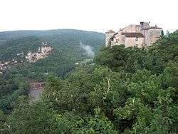
- Tarn-et-Garonne: Bruniquel
Notes
- This article is based on the equivalent article from the French Wikipedia, consulted on 23 April 2009.
References
This article is issued from
Wikipedia.
The text is licensed under Creative Commons - Attribution - Sharealike.
Additional terms may apply for the media files.