Utarp
| Utarp | |
|---|---|
 Utarp Location of Utarp within Wittmund district 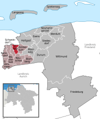  | |
| Coordinates: 53°37′N 07°28′E / 53.617°N 7.467°ECoordinates: 53°37′N 07°28′E / 53.617°N 7.467°E | |
| Country | Germany |
| State | Lower Saxony |
| District | Wittmund |
| Municipal assoc. | Holtriem |
| Government | |
| • Mayor | Harmine Bents (SPD) |
| Area | |
| • Total | 6.37 km2 (2.46 sq mi) |
| Elevation | 2 m (7 ft) |
| Population (2017-12-31)[1] | |
| • Total | 635 |
| • Density | 100/km2 (260/sq mi) |
| Time zone | CET/CEST (UTC+1/+2) |
| Postal codes | 26556 |
| Dialling codes | 0 49 75 |
| Vehicle registration | WTM |
Utarp is a municipality in the district of Wittmund, in Lower Saxony, Germany.
Towns and municipalities in Wittmund (district) | ||
|---|---|---|
References
| Authority control |
|---|
This article is issued from
Wikipedia.
The text is licensed under Creative Commons - Attribution - Sharealike.
Additional terms may apply for the media files.