Usqullu
| Usqullu | |
|---|---|
 | |
| Highest point | |
| Elevation | 5,000 m (16,000 ft) [1] |
| Coordinates | 15°26′52″S 72°29′20″W / 15.44778°S 72.48889°WCoordinates: 15°26′52″S 72°29′20″W / 15.44778°S 72.48889°W |
| Geography | |
 Usqullu Peru | |
| Location | Peru, Arequipa Region, Castilla Province |
| Parent range | Andes |
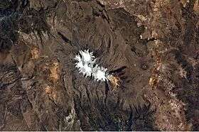
Usqullu (Quechua for Andean mountain cat,[2] hispanicized spelling Oscollo) is a mountain in the Andes of Peru, about 5,000 metres (16,404 ft) high. It is situated in the Arequipa Region, Castilla Province, Andagua District. Usqullu lies northwest of the peak of Wakapallqa (Huagapalca) and northeast of Puma Ranra and Usqullu Lake.[1]
References
This article is issued from
Wikipedia.
The text is licensed under Creative Commons - Attribution - Sharealike.
Additional terms may apply for the media files.