Urdaneta Municipality, Aragua
| Urdaneta Municipality Municipio Urdaneta | |
|---|---|
| Municipality | |
 Location in Aragua | |
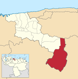
.svg.png) Urdaneta Municipality Location in Venezuela | |
| Coordinates: 9°36′44″N 66°44′51″W / 9.612261°N 66.747471°WCoordinates: 9°36′44″N 66°44′51″W / 9.612261°N 66.747471°W | |
| Country |
|
| State | Aragua |
| Municipal seat | Barbacoas |
| Government | |
| • Mayor | Sotero González (COPEI) |
| Area | |
| • Total | 2,024 km2 (781 sq mi) |
| Population (2011) | |
| • Total | 21,271 |
| • Density | 11/km2 (27/sq mi) |
| Time zone | UTC−04:00 (VET) |
| Area code(s) | 0246 |
| Website | Official website |
Urdaneta is one of the 18 municipalities (municipios) that makes up the Venezuelan state of Aragua and, according to the 2011 census by the National Institute of Statistics of Venezuela, the municipality has a population of 21,271. [1] The town of Barbacoas is the shire town of the Urdaneta Municipality.[2]
Name
The municipality is one of several in Venezuela named "Urdaneta Municipality" in honour of Venezuelan independence hero Rafael Urdaneta.
Demographics
The Urdaneta Municipality, according to a 2007 population estimate by the National Institute of Statistics of Venezuela, has a population of 21,270 (up from 19,339 in 2000). This amounts to 1.3% of the state's population.[3] The municipality's population density is 10.51 inhabitants per square kilometre (27.2/sq mi).[4]
Government
The mayor of the Urdaneta Municipality is Sotero González, re-elected on October 31, 2004 with 32% of the vote.[5][6] The municipality is divided into four parishes; Capital Urdaneta, Las Peñitas, San Francisco de Cara, and Taguay.[2]
References
- ↑ http://www.geohive.com/cntry/venezuela_ext.aspx
- 1 2 http://www.ine.gob.ve/secciones/division/Aragua.zip%5Bpermanent+dead+link%5D
- ↑ http://www.ine.gob.ve/sintesisestadistica/estados/aragua/cuadros/Poblacion5.xls%5Bpermanent+dead+link%5D
- ↑ http://www.ine.gob.ve/sintesisestadistica/estados/aragua/cuadros/Poblacion4.xls%5Bpermanent+dead+link%5D
- ↑ http://www.cne.gob.ve/regionales2004/4/alcaldedis=0&edo=4&mun=7&par=0&cen=0&mesa=0&cua=0.html
- ↑ http://www.cne.gob.ve/estadisticas/e016.pdf
External links
- urdaneta-aragua.gob.ve (in Spanish)