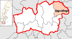
Uppvidinge Municipality
| Uppvidinge Municipality Uppvidinge kommun | ||
|---|---|---|
| Municipality | ||
| ||
 | ||
| Country | Sweden | |
| County | Kronoberg County | |
| Seat | Åseda | |
| Area[1] | ||
| • Total | 1,226.66 km2 (473.62 sq mi) | |
| • Land | 1,171.88 km2 (452.47 sq mi) | |
| • Water | 54.78 km2 (21.15 sq mi) | |
| Area as of 1 January 2014. | ||
| Population (31 December 2017)[2] | ||
| • Total | 9,561 | |
| • Density | 7.8/km2 (20/sq mi) | |
| Time zone | UTC+1 (CET) | |
| • Summer (DST) | UTC+2 (CEST) | |
| ISO 3166 code | SE | |
| Province | Småland | |
| Municipal code | 0760 | |
| Website | www.uppvidinge.se | |

Uppvidinge Municipality (Uppvidinge kommun) is a municipality in Kronoberg County, southern Sweden, with its seat in the town of Åseda.
The present municipality, which took its name from a hundred, was formed by the local government reform of 1971 when Lenhovda, Nottebäck, Åseda and Älghult were amalgamated. The number of original entities, as of 1863, is six. The first amalgamation in the area (Granhult merged with Nottebäck) took place already in 1915.
The municipality has a rather small population but states "In a Small Municipality Man Becomes Large".
More than 80% of the area is covered with forests, making it live up to the general public's impression of the "dark" province of Småland. The name Uppvidinge itself means something like forest on a hill. The coat of arms is based on the insignia of Uppvidinge Hundred, from a document from 1568. It depicts a herb of unknown species in a red color.
Localities
There are 5 urban areas (also called a Tätort or locality) in Uppvidinge Municipality.
In the table the localities are listed according to the size of the population as of December 31, 2005. The municipal seat is in bold characters.
| # | Locality | Population |
|---|---|---|
| 1 | Åseda | 2,430 |
| 2 | Lenhovda | 1,714 |
| 3 | Norrhult-Klavreström | 1,269 |
| 4 | Alstermo | 859 |
| 5 | Älghult | 481 |
References
- ↑ "Statistiska centralbyrån, Kommunarealer den 1 januari 2014" (Microsoft Excel) (in Swedish). Statistics Sweden. Retrieved 2014-04-18.
- ↑ "Folkmängd i riket, län och kommuner 31 december 2017" (in Swedish). Statistics Sweden. February 21, 2018. Retrieved February 21, 2018.
Notes
External links
- Uppvidinge Municipality - Official site
- Coat of arms
Municipalities and seats of Kronoberg County | ||
|---|---|---|
| Municipalities | ||
| Municipal seats | ||