Uppada
| Uppada | |
|---|---|
| Village | |
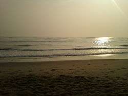
 Uppada beach | |
 Uppada Location in Andhra Pradesh, India  Uppada Uppada (India) | |
| Coordinates: 17°05′00″N 82°20′00″E / 17.0833°N 82.3333°ECoordinates: 17°05′00″N 82°20′00″E / 17.0833°N 82.3333°E | |
| Country | India |
| State | Andhra Pradesh |
| District | East Godavari |
| Area[1] | |
| • Total | 4.05 km2 (1.56 sq mi) |
| Elevation[2] | 15 m (49 ft) |
| Population (2011) | |
| • Total | 3,632 |
| • Density | 900/km2 (2,300/sq mi) |
| Languages | |
| • Official | Telugu |
| Time zone | UTC+5:30 (IST) |
| Climate | hot (Köppen) |
Uppada is a village in East Godavari district of the Indian state of Andhra Pradesh. It is located in Kothapalli mandal of Kakinada revenue division.[1] Uppada Jamdani Sari is a handcrafted sari woven at the village and is also a geographical indication of Andhra Pradesh.[3] It is popular Fishery station for Prawns.[4]
Geography
Uppada is located at 17°05′18″N 82°20′00″E / 17.0883°N 82.3333°E and at an altitude of 15 m (49 ft).[2] The village is spread over an area of 4.50 km2 (1.74 sq mi) and is located on the west coast of Bay of Bengal.[1]
See also
References
- 1 2 3 "District Census Handbook - East Godavari" (PDF). Census of India. pp. 16–378. Retrieved 28 January 2016.
- 1 2 "Maps, Weather, and Airports for Uppada, India". fallingrain.com.
- ↑ "State Wise Registration Details of G.I Applications" (PDF). Geographical Indication Registry. p. 4. Archived from the original (PDF) on 1 February 2016. Retrieved 28 January 2016.
- ↑ Fishing Trials with Beachlanding Craft at Uppada, Andhra,Pradesh, India by L.Nyberg, 1987.
This article is issued from
Wikipedia.
The text is licensed under Creative Commons - Attribution - Sharealike.
Additional terms may apply for the media files.