Unionville, Georgia
| Unionville, Georgia | |
|---|---|
| CDP | |
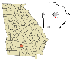 Location in Tift County and the state of Georgia | |
| Coordinates: 31°26′7″N 83°30′32″W / 31.43528°N 83.50889°WCoordinates: 31°26′7″N 83°30′32″W / 31.43528°N 83.50889°W | |
| Country | United States |
| State | Georgia |
| County | Tift |
| Area | |
| • Total | 0.7 sq mi (1.9 km2) |
| • Land | 0.7 sq mi (1.9 km2) |
| • Water | 0 sq mi (0 km2) |
| Elevation | 351 ft (107 m) |
| Population (2000) | |
| • Total | 2,074 |
| • Density | 2,962.9/sq mi (1,091.6/km2) |
| Time zone | UTC-5 (Eastern (EST)) |
| • Summer (DST) | UTC-4 (EDT) |
| FIPS code | 13-78464[1] |
| GNIS feature ID | 0333309[2] |
Unionville is a census-designated place (CDP) in Tift County, Georgia, United States. The population was 2,074 at the 2000 census.
Geography
Unionville is located at 31°26′7″N 83°30′32″W / 31.43528°N 83.50889°W (31.435302, -83.508824).[3] According to the United States Census Bureau, the CDP has a total area of 0.8 square miles (2.1 km2), all land.
Demographics
At the 2000 census,[1] there were 2,074 people, 750 households and 521 families residing in the CDP. The population density was 2,766.6 per square mile (1,067.7/km²). There were 859 housing units at an average density of 1,145.9 per square mile (442.2/km²). The racial makeup of the CDP was 1.45% White, 96.96% African American, 0.05% Native American, 0.05% Asian, 0.68% from other races, and 0.82% from two or more races. Hispanic or Latino of any race were 1.16% of the population.
There were 750 households of which 30.5% had children under the age of 18 living with them, 32.3% were married couples living together, 30.8% had a female householder with no husband present, and 30.5% were non-families. 25.5% of all households were made up of individuals and 11.3% had someone living alone who was 65 years of age or older. The average household size was 2.77 and the average family size was 3.37.
29.2% of the population were under the age of 18, 10.2% from 18 to 24, 26.0% from 25 to 44, 21.3% from 45 to 64, and 13.4% who were 65 years of age or older. The median age was 34 years. For every 100 females, there were 87.0 males. For every 100 females age 18 and over, there were 75.7 males.
The median household income was $23,430 and the median family income was $23,372. Males had a median income of $22,143 compared with $19,223 for females. The per capita income was $11,699. About 33.4% of families and 33.1% of the population were below the poverty line, including 36.3% of those under age 18 and 32.2% of those age 65 or over.
In 2010, Unionville had the 17th-lowest median household income of all places in the United States with a population over 1,000.[4]
References
- 1 2 "American FactFinder". United States Census Bureau. Retrieved 2008-01-31.
- ↑ "US Board on Geographic Names". United States Geological Survey. 2007-10-25. Retrieved 2008-01-31.
- ↑ "US Gazetteer files: 2010, 2000, and 1990". United States Census Bureau. 2011-02-12. Retrieved 2011-04-23.
- ↑ "US Census". Retrieved 18 January 2014.
Municipalities and communities of Tift County, Georgia, United States | ||
|---|---|---|
| Cities | 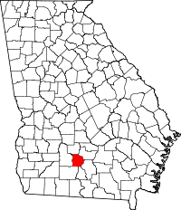 | |
| CDPs | ||
| Unincorporated communities | ||
| Footnotes | ‡This populated place also has portions in an adjacent county or counties | |