Una River (Pernambuco)
| Una | |
|---|---|
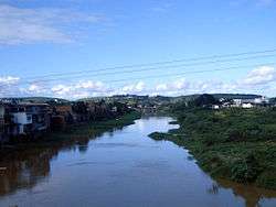 The Una near Palmares | |
| Country | Brazil |
| Physical characteristics | |
| Main source | Borborema Plateau, Pernambuco |
| River mouth |
Atlantic Ocean 8°51′40″S 35°07′48″W / 8.861°S 35.13°WCoordinates: 8°51′40″S 35°07′48″W / 8.861°S 35.13°W |
| Length | 290 km (180 mi) |
| Basin features | |
| Basin size | 6,740 km2 (2,600 sq mi) |
The Una River is a river of Pernambuco state in northeastern Brazil. The Una originates on the Borborema Plateau, flows east, and empties into the Atlantic Ocean near Barreiros. Its length is 290 km, and its basin area is 6,740 km2, of which 6,263 km2 in Pernambuco.[1] It flows through the towns São Bento do Una, Altinho, Palmares and Agua Preta.[2]
References
This article is issued from
Wikipedia.
The text is licensed under Creative Commons - Attribution - Sharealike.
Additional terms may apply for the media files.