Abu Ageila
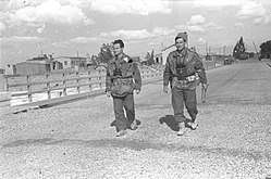
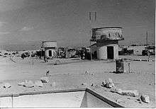
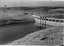
Abu Ageila is a strategically important road junction and dam in the north of the Sinai peninsula, because of its proximity to the border with Israel, approximately 25 km from Auja al-Hafir and 45 km southeast of El Arish. It was the site of major battles in the 1948, 1956 and 1967 wars between Israel and Egypt. The adjacent location Umm Katef (Arabic: أم كاتف) was another key Egyptian position in the Abu Ageila battles.[1]
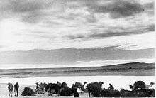
In 1930, there were about 10,000 and, in 1948, only 3,500 'Azazme living in this area. Furthermore, the ownership of the land they inhabited was often disputed.[2][3]
According to a recent biography of Ariel Sharon by David Landau, in preparation for an attack on the Suez Canal were war to break out between Israel and Egypt, Sharon ordered the secret expulsion of 3,000 Bedouin from Abu Ageila, in late January 1972, to clear the way for a military exercise code-named Oz (valour). No warning was given, and the expulsion order was executed during the onset of freezing temperatures in the desert, over three days. Moreover, no time was allowed for the Bedouin (nomadic tribes) - the 'Azazme, kin to the Tarabin in El Arish[4] - to collect their belongings. As a result, some forty died, predominantly children, babies and old people, as they were forced to relocate to Gabal Khalal mountain. Israeli IDF members associated with the expulsion said later that Sharon probably intended to use the land for an Israeli settlement. Lt. Gen. David Elazar later ordered that the Bedouin be allowed to return.[5]
References
- ↑ Gawrych, G.W. (2014). Key To The Sinai: The Battles For Abu Agelia In The 1956 And 1967 Arab Israeli Wars [Illustrated Edition]. Pickle Partners Publishing. ISBN 9781782895794. Retrieved 22 November 2016.
- ↑ Suwaed, Muhammad (2015). Historical Dictionary of the Bedouins. Rowman & Littlefield Publishers. p. 30. ISBN 9781442254510. Retrieved 22 November 2016.
- ↑ Lancaster, William; Lancaster, Fidelity (1999). People, Land and Water in the Arab Middle East: Environments and Landscapes in the Bilâd Ash-Shâm. Harwood Academic Publishers. p. 120. ISBN 9789057023224. Retrieved 22 November 2016.
- ↑ Chatty, Dawn (2006). Nomadic Societies in the Middle East And North Africa: Entering the 21st Century. Brill. p. 905. ISBN 9789004147928.
- ↑ Anshel Pfeffer, 'Sharon ordered expulsion of 3,000 Bedouin, new biography reveals ,' Archived 2014-02-13 at the Wayback Machine. at Haaretz, 11 February 2014
Coordinates: 30°50′35.30″N 34°07′03.84″E / 30.8431389°N 34.1177333°E