Ujar District
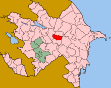
Ujar Rayon (Ucar Rayonu[1]) is a rayon (administrative district) of Azerbaijan, situated to the south of Goycay, 234 km out of Baku, in the centre of the country. This region contains the Baku-Tbilisi-Ceyhan pipeline to the south of the Shirvan plain.[2]
History
The name Ucar derives from the Turkic word "Ucqar" meaning "remote", as Ucar was remote from the Shirvanshah capital at Baku, and on the frontier of the Shirvan state.[3]
Before, the territory of the Ujar region was part of the Shirvan Beylerbey, later Shamakhi khanate. On April 10, 1840, according to the administrative reform, it was the part of Caspian Province, and in 1846, joined to the Shamakhi Governorate. After the Shamakhi earthquake in 1859, the center of the Governorate moved to Baku. [4] In December 1867, Goychay Uyezd was established in the territory of Baku province. At that time, the district was part of the Goychay Uyezd. In 1930, the Uyezd was abolished and the district was transferred to the administrative unit. Thus, the Ujar Rayon was created on 24 January 1939 as an independent administrative unit from part of Goychay region.[5][4] The territory of region was changed in 1963. Thus, Zardab district was abolished in 1963 with its territory joined to the Ujar district. In 1965, the Zardab district was separated from Ucar when it was restored as an independent region. [4]
Population
As of 2009, Ujar Rayon had an estimated population of 77,900 people, of which 22% were urban dwellers and 78% rural.[6] The population is 99.7% Azerbaijanis. According to the report of Statistical Committee of Republic, the total number of population in 2010 was 71.9 thousand people. By 2018, increased by 15,800 and reached 87.7.
| Towns and regions | 2000 | 2001 | 2002 | 2003 | 2004 | 2005 | 2006 | 2007 | 2008 | 2009 | 2010 | 2011 | 2012 | 2013 | 2014 | 2015 | 2016 | 2017 | 2018 |
| Ujar region | 71,9 | 72,3 | 72,8 | 73,2 | 73,9 | 74,7 | 75,5 | 76,3 | 77,2 | 77,9 | 78,8 | 79,8 | 80,7 | 81,8 | 82,9 | 84,1 | 85,4 | 86,6 | 87,7 |
| urban population | 15,6 | 15,7 | 15,8 | 15,9 | 16,7 | 17,0 | 17,1 | 17,2 | 16,7 | 16,8 | 16,9 | 17,0 | 17,1 | 17,1 | 17,3 | 17,5 | 17,7 | 17,8 | 18,0 |
| rural population | 56,3 | 56,6 | 57,0 | 57,3 | 57,2 | 57,7 | 58,4 | 59,1 | 60,5 | 61,1 | 61,9 | 62,8 | 63,6 | 64,7 | 65,6 | 66,6 | 67,7 | 68,8 | 69,7 |
Rivers and water resources
Main rivers are Goychay and Turyan (Garasu) rivers. Tikanlichay, one of the main rivers, starts from the south-western slope of the Bazarduzu mountain. The river has 10 branches. The Goychay River starts from the Lahij mountain system - the western slope of Kovdag (1980 m). [8]
Administration
There are 32 villages and 1 city in Ucar. The largest communities are Qazyan, Müsüslü and Qarabörk.[2]
Chief executives
Municipalities
Ujar Rayon is divided into twenty-nine municipalities.
- Ujar Municipality is coëxtensive with the city of Ucar
- Məlikballı Municipality
- Müsüslü Municipality
- Qarabörk Municipality
- Qazyan Municipality
- Alpi Municipality
- Gazigumlag Municipality
- Ramal Municipality
- Garadaghli Municipality
- Alpout Municipality
- Gazyan Municipality
- Lak Municipality
- Boyat Municipality
- Khelej Municipality
- Upper Shilyan Municipality
- Mususlu Municipality
- Garajalli Municipality
- Bergushad Municipality
- Upper Chiyni Municipality
- Gulabend Municipality
- Garabork Municipality
- Resteje Municipality
See also
References
- ↑ "Ucar Rayonu (Approved)" Ujar District at GEOnet Names Server, United States National Geospatial-Intelligence Agency
- 1 2 "Territorial and administrative units of Azerbaijan" (PDF).
- ↑ Eminov, Zakir Namin oğlu (2005) Azärbaycanın ähalisi: iqtisadi, sosial vä demoqrafik problemlär Baku, page 157, OCLC 254902980, in Azeri
- 1 2 3 "Ujar region".
- ↑ "Ujar Rayon" Supreme Court of Azerbaijan, in Russian, last accessed 12 November 2010
- ↑ "Demographic indicators" The State Statistical Committee of the Republic of Azerbaijan
- ↑ "Political division, population size and structure: Population by towns and regions of the Republic of Azerbaijan".
- ↑ "Geographical position".
- ↑ "Ильхам Алиев подписал распоряжение о снятии Арзу Тельман оглу Гафурова с должности главы Исполнительной власти Уджарского района ("Ilham Aliyev signed a decree withdrawing Arzu Telman oglu Gafurova from the office of the chief executive of the Ujar region"" (in Russian). "The First News". 5 April 2010.
- ↑ "Ильхам Алиев подписал распоряжение о назначении Яшара Гахраман оглу Мамедова главой Исполнительной власти Уджарского района ("Ilham Aliyev signed a decree on the appointment of Yashar oglu Mammadov Qahraman chief executive of the Ujar region")" (in Russian). "The First News". 5 April 2010. Archived from the original on 12 November 2010. , archived at
.svg.png)