Uhorské
| Uhorské | |
| Municipality | |
 Yeoman mansion | |
| Country | Slovakia |
|---|---|
| Region | Banská Bystrica |
| District | Poltár |
| Elevation | 251 m (823 ft) |
| Coordinates | 48°28′N 19°45′E / 48.467°N 19.750°ECoordinates: 48°28′N 19°45′E / 48.467°N 19.750°E |
| Area | 22.485 km2 (8.68 sq mi) |
| Population | 564 (2011[1]) |
| Density | 25/km2 (65/sq mi) |
| First mentioned | 1362 |
| Postal code | 985 25 |
| Area code | +421-47 |
| Car plate | PT |
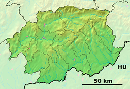 Location of Uhorské in the Banská Bystrica Region  Uhorské (Slovakia) | |
| Statistics: MOŠ/MIS | |
| Website: www.uhorske.sk | |
Uhorské is a village and municipality in the Poltár District in the Banská Bystrica Region of Slovakia. In the village is football pitch, foodstuff store, post, local library, kindergarten and elementary school. The village have remained its agricultural characteristics. Most important sightseeing is evangelical church from 1700, which stands under state cultural protection.
| Wikimedia Commons has media related to Uhorské. |
References
This article is issued from
Wikipedia.
The text is licensed under Creative Commons - Attribution - Sharealike.
Additional terms may apply for the media files.