Uga, Anambra
| Uga | |
|---|---|
| Town | |
| Nickname(s): Uga Ntụtụ Akwụ | |
 Uga Location in Nigeria | |
| Coordinates: 5°56′N 7°05′E / 5.933°N 7.083°ECoordinates: 5°56′N 7°05′E / 5.933°N 7.083°E | |
| Country |
|
| State | Anambra State |
| Local Government | Aguata |
| Town | Uga |
| Communities |
|
| Obi of Uga | dated 700 AD |
| Government | |
| • Type | Traditional Hereditary Monarchy |
| • Obi | H.R.H Igwe Chidi Ezenwugo Ezeobiaeri |
| Demonym(s) | Onye Uga, Ndị Uga, Ụmụ Ụga |
| Time zone | UTC+1 (WAT) |
| Postal code | 422124 [1] |
| Area code(s) | 046 |
| Climate | Aw |
Uga is a town in Aguata Local Government Area of Anambra State, Nigeria. It is 13 km South East of Igbo-Ukwu, 12 km South of Ekwulobia, and 45 km South of Awka, the Anambra State Capital . It has four (4) communities namely : Umueze, Oka, Umuoru and Awarasi. It has recognised landmarks and tourist attractions such as the "Obizi Uga", a natural spring and a spectacular scenery which was the site of an ancient tale in the Uga oral tradition. Uga is the site of an annual traditional celebration known as the "OBUOFOR" festival held every 26th December. Uga has one of the largest markets in the Aguata local government area known as "ORIE" which supports the economic activities of the local community and other surrounding towns.
The town has an official Post Office.[2]
Nigerian Civil War
Uga was an important theatre in the Biafran War by hosting an airstrip alongside Uli and rising to prominent use after the major strip in Uli was destroyed. Biafra’s two main airfields were at Enugu and Port Harcourt. Three other landing grounds existed at Calabar, Owerri and Ogoja, but with little (if any) landing facilities, such as landing aids, etc. The loss of Enugu, Biafra Capital in 04 October 1967 and two weeks later Calabar in the South East helped the Federal troops to control the Biafra-Cameroon border and seal off the Biafran coastal ports. The Biafran Pilots were forced to transfer international communications, including valuable arms flights to Port Harcourt which became Biafra’s main outlet to the world till May 1968. It was the loss of Enugu that prompted the concept of establishing a series of secret airstrips in the Biafran hinterland and a team of Biafran engineers began to select the possible sites. So the effort concentrated upon the site, codenamed “Annabelle”, just to the South of the village at Uli. By far the largest of the projected new airstrips, Uli became synonymous with the entire Biafran effort to survive. Next to the “Rising Sun” National insignia, it undoubtedly became the best known symbol of Biafra. The strip was converted from a stretch of the main Owerri to Ihiala road. Nevertheless it was commented by one airlift pilot much later, “a nice wide road, but a damned narrow runway”. For inbound flights Uli operated only between the hours of darkness officially from 17:00 to 05:00 UTC or GMT at the time. Landing was only permissible after the crew had transmitted the correct landing-code for the night. The coded phases changed regularly. Towards the end of January 1969 the Biafran Air Force introduced a new frequency shift system for the final approach and landing phase. With this new arrangement, pilots initially contact Biafra Air Control Center (ACC) using the normal code format. As soon the contact with an inbound aircraft was established and confirmed. then, depending of weather, enemy activity, traffic, ACC would then clear the aircraft to Uli tower in plain language to until touchdown. Ihiala is just off the road, along the approach to Uli had a Church with two tall spires, visible on approach to Uli. Landing planes passed just over it. Many aviators were buried there. By the end of war 35 airmen were buried there. Nigeria bulldozed the graves. [3]
Uga Air Strip
Disgusted by the suffering and mounting death toll in Biafra from starvation as well as the continuous harassment of the relief planes by the Nigerian Air Force, Carl Gustaf von Rosen resigned as a Red Cross relief pilot and helped Biafra to form an Airforce of five Minicoin planes Malmö MFI-9 stationed at the Uga airstrip. He named his tiny but effective airforce "Babies of Biafra" in honour of the babies who died via starvation inside Biafra. [4]
Uga was only 27 kilometers to the North-east of Uli. Like Uli the strip at Uga was converted from a stretch of the main Orlu to Awka road. By the end of 1968, it was declared operational but only as a secondary strip to Uli and strictly for Government and Military usage only. The first known landing of a regular Military flight to Uga came on the night of 10/11 May 1969 when Jack Matlock and crew, flew one of his own DC-7CFs, into Uga. None relished the idea of using Uga airstrip again. The landing surface was not as good as Uli with considerable amounts of lose stone and shingles. The surface proved to be a major hazard especially when putting heavily-laden DC-7CF into reverse pitch after landing. Contrary to popular belief, very few flights were made by DC-7s or L-1049Gs into Uga. Uga was the T-6Gs base, From here we took off for targets in the front line, Air Bases and in the back of enemy lines. The Head Quarters chose the targets, we executed them. If necessary in emergency or with the Migs 17 overflying our base, we had South of Umuahia another airstrip at Mbawsi. The Migs 17 locate the airstrip and several retaliation attacks were carried out against the strip on 26 November and 1 December in the hope of either hitting the aircraft or rendering the strip sufficiently deniable for use. The NAF bombed and strafed Uga many times but never hit a plane or one of us. There is God. The bombs are not for us, O di naka Chukwu.[3]
Geography and Climate
Obizi is a spring located in Uga and a major source of potable water and water recreation. In 2017, the Anambra Government in partnership with World Bank spent about N1.2 billion to reactivate the Obizi Water Scheme. The water project was the biggest in the state and when completed, would be expected to provide water to Uga and 45 communities in Aguata and its environs. [5]
Culture and Arts
Obuofor
The is one of the numerous historic event that Uga people remember each year. Obuofo memorial is a symbol of staunch of indigenous believe system destroyed by the advent of Christianity. It was not so easy to do that as many notable indigenes fought valiantly to defend who they were and their believe system. in 1910.
Notable People
- Emmanuel Nnamdi Uba, Senator Representing Anambra South Senatorial District at the National Assembly
- Rev Prof John Bosco Akam, Founder Tansian University [6]
References
- ↑ Nigerian Postal Service. "Postcode Map". Archived from the original on October 7, 2009. Retrieved 2018-04-16.
- ↑ "Post Offices- with map of LGA". NIPOST. Archived from the original on 2009-10-07. Retrieved 2009-10-20.
- 1 2 "Uli and Uga Airstrip: The Ingenuity of Republic of Biafra". The Biafran. 2014. Retrieved 16 April 2018.
- ↑ Gary Brecher. Biafra: Killer Cessnas and Crazy Swedes Archived 2008-01-14 at the Wayback Machine. 15 October 2004.
- ↑ "Obizi Water Project:Anambra Partners With World Bank". PM News. Retrieved 22 April 2018.
- ↑ "National Universities Commission". National Universities Commission,Nigeria. Archived from the original on 1 July 2013. Retrieved 4 July 2013.
State capital: Awka | ||
| Local Government Areas | 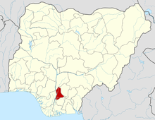 | |