Uchku
| Uchku | |
|---|---|
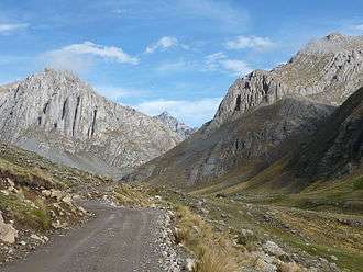 Uchku (on the left) | |
| Highest point | |
| Elevation | 4,800 m (15,700 ft) [1] |
| Coordinates | 12°23′05″S 75°42′05″W / 12.38472°S 75.70139°WCoordinates: 12°23′05″S 75°42′05″W / 12.38472°S 75.70139°W |
| Geography | |
 Uchku Peru | |
| Location | Peru, Lima Region |
| Parent range | Andes, Cordillera Central |
Uchku (Quechua for hole, pit,[2][3] also spelled Uchco) is mountain in the Cordillera Central in the Andes of Peru which reaches a height of approximately 4,800 metres (15,748 ft) high. It is located in the Lima Region, Yauyos Province, Laraos District. Uchku lies southwest of a lake named Pumaqucha.[1] The entrance to Sima Pumaqucha, one of the deepest caves of South America, is on the southern slope of the mountain.
Gallery
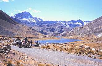 Cavers at Pumaqucha offloading equipment for Sima Pumaqucha. The southern slopes of Uchku are on the left.
References
- 1 2 escale.minedu.gob.pe - Map of the Yauyos Province (Lima Region)
- ↑ Vocabulario comparativo quechua ecuatoriano - quechua ancashino -- castellano - English (pdf)
- ↑ "Traduzca Uchku para Español". babylon. Retrieved May 24, 2016.
This article is issued from
Wikipedia.
The text is licensed under Creative Commons - Attribution - Sharealike.
Additional terms may apply for the media files.