Special routes of U.S. Route 79
| |
|---|---|
| Highway system | |

A total of twelve special routes of U.S. Route 79 exist, divided between the states of Arkansas, Louisiana, Tennessee and Texas. Currently, they are all business routes, except for one bypass of Humboldt, Tennessee, and one bypass of Homer, Louisiana.
Taylor business route
| |
|---|---|
| Location | Taylor, Texas |
| Length | 3.246 mi[1] (5.224 km) |
Business U.S. Highway 79-B begins at the intersection of mainline US 79 and SH 95 in southern Taylor. The business route travels northward along Main Street, concurrent with SH 95, and intersects FM 112. It then turns to the east along 4th Street to rejoin mainline US 79 at the city limits.[1][2]

The business route through Taylor was originally designated on January 20, 1966 as Loop 427; on March 1, 1972, the western terminus extended north to Lake Drive. On October 6, 1972, the route had been designated to serve as a full loop around the city.[3] What is now currently mainline US 79 in southern Taylor was originally part of the loop route, and the designations would be switched on January 20, 1977. In addition, the old route of US 79 was marked as Business US 79. On April 26, 1978, the section north of Taylor was cancelled. The section from SH 95 east and south to US 79 was cancelled, as it was never built, while the section from US 79 north and east to SH 95 was given the new designation of FM 397. The designation was changed from Loop 427 on June 21, 1990, and the western segment along 2nd St, 4th St, Main St, and Porter St was cancelled, and was replaced with the segment concurrent with SH 95 on April 25, 2002. On June 24, 2010, the section along Second Street from US 79 east to SH 95 was given to the city of Taylor, and Business US 79-B was rerouted south along SH 95 to US 79.[1]
Henderson business route
| |
|---|---|
| Location | Henderson, Texas |
| Length | 2.583 mi[4] (4.157 km) |
Business U.S. Highway 79-F begins at US 79 in southeastern Henderson and travels northward along Jacksonville Drive and South Main Street. It turns eastward at its intersection with FM 13, briefly running concurrently with Bus. SH 64 along East Main Street. The route ends at US 79 / US 259 near Willow Lake; East Main Street continues past this intersection as FM 840.[5]
Sections of roadway that are now Bus. US 79-F and Bus. SH 64-E were originally designated in 1944 as both Loop 153 and Loop 154.[6][7] These designations were changed to the current business routes on June 21, 1990.[4][8]


Carthage business route
| |
|---|---|
| Location | Carthage, Texas |
| Length | 2.92 mi[9] (4.70 km) |
Business U.S. Highway 79-G travels through Carthage while mainline US 79 loops around the city to the north. The route begins at US 79 / SH 149 in eastern Carthage. The route travels eastward along Panola Street, passing Panola College and a junction with SH 315, before intersecting Bus. US 59 at a traffic circle. After leaving the traffic circle along Sabine Street, Bus. US 79-G continues eastward until it ends at a diamond interchange with US 79 / US 59.[10]
Bus. US 79-G was designated in 1981 as Loop 334; it was the second route to bear that designation.[11] The mileage was transferred to Bus. US 79-G in 1991.[9]
Homer bypass route
| |
|---|---|
| Location | Homer, Louisiana |
In Homer, the U.S. Highway 79 Bypass begins at an intersection with US 79 and LA 9 south of the town. The bypass runs west of the town and overlaps LA 2 for about the last 1 1/2 miles before ending at US 79 north of town.
- Junction list
The entire highway is in Claiborne Parish.
| Location | mi | km | Destinations | Notes | |
|---|---|---|---|---|---|
| | Southern terminus | ||||
| Homer | |||||
| | South end of LA 2 overlap | ||||
| Homer | Northern terminus; north end of LA 2 overlap | ||||
1.000 mi = 1.609 km; 1.000 km = 0.621 mi
| |||||
Magnolia business route
| |
|---|---|
| Location | Magnolia, Arkansas |
| Length | 1.77 mi[12] (2.85 km) |
| Existed | c. 1967–present |
U.S. Route 79 Business (US 79B and Hwy. 79B) is a 1.77-mile (2.85 km) business route of U.S. Route 79 in Columbia County, Arkansas.[13]
- Route description
The route's southern terminus is at US 79 at the southern city limits of Magnolia. The route runs north as Jackson Street through residential areas until meeting Highway 19. The two routes begin a concurrency northbound towards downtown Magnolia where US 79B/AR 19 both terminate at US 82B (E Main Street). This junction also serves as the southern terminus of Highway 355.[13]
- Major intersections
The entire route is in Magnolia, Columbia County.
| mi[13] | km | Destinations | Notes | ||
|---|---|---|---|---|---|
| 0.00 | 0.00 | Southern terminus | |||
| 1.02 | 1.64 | Begin AR 19 concurrency north | |||
| 1.77 | 2.85 | Northern terminus, AR 19 northern terminus, AR 355 southern terminus | |||
1.000 mi = 1.609 km; 1.000 km = 0.621 mi
| |||||
Camden business route
| |
|---|---|
| Location | Camden, Arkansas |
| Length | 5.41 mi[12] (8.71 km) |
Bearden business route

| |
|---|---|
| Location | Bearden, Arkansas |
| Length | 3.57 mi[12] (5.75 km) |
Thornton business route
| |
|---|---|
| Location | Thornton, Arkansas |
| Length | 2.14 mi[12] (3.44 km) |
Fordyce business route
| |
|---|---|
| Location | Fordyce, Arkansas |
| Length | 3.30 mi[12] (5.31 km) |
Pine Bluff/Altheimer business route
| |
|---|---|
| Location |
Pine Bluff, Arkansas Altheimer, Arkansas |
| Length | 15.44 mi[12] (24.85 km) |
U.S. Route 79-B in Pine Bluff begins at I-530/US 65/US 79, southwest of Downtown. The highway runs east of the city center and north toward Altheimer. The highway meets its parent route before running through town and terminates north of town.
- Junction list
The entire route is in Jefferson County.
| Location | mi | km | Destinations | Notes | |
|---|---|---|---|---|---|
| Pine Bluff | Southern terminus | ||||
| South end of US 65B overlap | |||||
| North end of US 65B overlap | |||||
| | |||||
| Altheimer | |||||
| | Northern terminus | ||||
1.000 mi = 1.609 km; 1.000 km = 0.621 mi
| |||||
Stuttgart business route
| |
|---|---|
| Location | Stuttgart, Arkansas |
| Length | 2.10 mi[12] (3.38 km) |
Clarendon business route
| |
|---|---|
| Location | Clarendon, Arkansas |
| Length | 1.00 mi[12] (1.61 km) |
Former McNeil city route
| |
|---|---|
| Location | McNeil, Arkansas |
| Length | 0.94 mi[12] (1.51 km) |
US Highway 79C was a city route in McNeil, Arkansas. The route was redesignated as Highway 98B in 1970.[14]
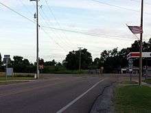
Humboldt bypass route
| |
|---|---|
| Location | Humboldt, Tennessee |
References
- 1 2 3 Transportation Planning and Programming Division (n.d.). "Business U.S. Highway No. 79-B". Highway Designation Files. Texas Department of Transportation. Retrieved August 30, 2013.
- ↑ Transportation Planning and Programming Division (2014). Texas County Mapbook (PDF) (Map) (2014 ed.). 1:120,000. Texas Department of Transportation. p. 395. Retrieved December 3, 2014.
- ↑ Transportation Planning and Programming Division (n.d.). "State Highway Loop No. 427". Highway Designation Files. Texas Department of Transportation. Retrieved August 30, 2013.
- 1 2 Transportation Planning and Programming Division (n.d.). "Business U.S. Highway No. 79-F". Highway Designation Files. Texas Department of Transportation. Retrieved August 30, 2013.
- ↑ Transportation Planning and Programming Division (2014). Texas County Mapbook (PDF) (Map) (2014 ed.). 1:120,000. Texas Department of Transportation. p. 508. Retrieved December 3, 2014.
- ↑ Transportation Planning and Programming Division (n.d.). "State Highway Loop No. 153". Highway Designation Files. Texas Department of Transportation. Retrieved August 30, 2013.
- ↑ Transportation Planning and Programming Division (n.d.). "State Highway Loop No. 154". Highway Designation Files. Texas Department of Transportation. Retrieved August 30, 2013.
- ↑ Transportation Planning and Programming Division (n.d.). "Business State Highway No. 64-E". Highway Designation Files. Texas Department of Transportation. Retrieved August 30, 2013.
- 1 2 Transportation Planning and Programming Division (n.d.). "Business U.S. Highway No. 79-G". Highway Designation Files. Texas Department of Transportation. Retrieved August 30, 2013.
- ↑ Transportation Planning and Programming Division (2014). Texas County Mapbook (PDF) (Map) (2014 ed.). 1:120,000. Texas Department of Transportation. p. 526. Retrieved December 3, 2014.
- ↑ Transportation Planning and Programming Division (n.d.). "State Highway Loop No. 334". Highway Designation Files. Texas Department of Transportation. Retrieved August 30, 2013.
- 1 2 3 4 5 6 7 8 9 Planning and Research Division (2010). "Arkansas Road Log Database". Arkansas State Highway and Transportation Department. Archived from the original (Database) on 23 June 2011. Retrieved June 9, 2011.
- 1 2 3 General Highway Map, Columbia County, Arkansas (PDF) (Map). 1:62500. Cartography by Planning and Research Division. Arkansas State Highway and Transportation Department. February 14, 2008. Retrieved December 12, 2012.
- ↑ "Minutes of the Meeting" (PDF). Arkansas State Highway Commission. May 27, 1970. p. 1619. Retrieved January 28, 2013.