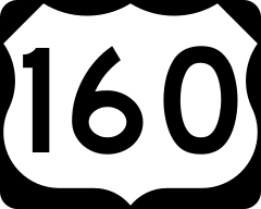
U.S. Route 160 in New Mexico
| ||||
|---|---|---|---|---|
| Route information | ||||
| Maintained by NMDOT | ||||
| Length | 0.891 mi[1] (1.434 km) | |||
| Existed | 1970–present | |||
| Major junctions | ||||
| West end |
| |||
| East end |
| |||
| Highway system | ||||
| ||||
U.S. Route 160 (US 160) is a U.S. Highway in the extreme northwestern corner of New Mexico near the Four Corners area.
Route description
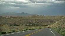
US 160 enters New Mexico from Arizona on a two-lane highway that heads northeast through the arid, rolling plains of the Navajo section of the Colorado Plateau. Approximately 0.3 miles (480 m) into the state is an intersection with New Mexico State Road 597 (NM 597), a short highway that leads to the Four Corners Monument, which lies on the quadripoint of Arizona, New Mexico, Colorado, and Utah.[2] US 160 continues to the northeast and descends into the San Juan River valley, but the highway crosses into Colorado before reaching the river.[3]
History
| |
|---|---|
| Location | Flagstaff, AZ–Cortez, CO |
| Existed | 1964–1970 |
US 160 was originally US 164 in 1964, but was realigned as part of a reconstruction project in 1970.[4]
Junction list
The entire route is in San Juan County.
| mi[1] | km | Destinations | Notes | ||
|---|---|---|---|---|---|
| 0.000 | 0.000 | Continuation into Arizona | |||
| 0.290 | 0.467 | ||||
| 0.891 | 1.434 | Continuation into Colorado | |||
| 1.000 mi = 1.609 km; 1.000 km = 0.621 mi | |||||
See also

References
- 1 2 "TIMS road segments by posted route/point with AADT info" (PDF). New Mexico Department of Transportation. June 8, 2016. p. 29. Retrieved June 25, 2016.
- ↑ Navajo Parks & Recreation (n.d.). "Four Corners Monument". Navajo Parks & Recreation. Archived from the original on April 27, 2009. Retrieved May 28, 2016.
- ↑ Google (May 27, 2016). "Overview map of US 160 in New Mexico" (Map). Google Maps. Google. Retrieved May 27, 2016.
- ↑ Sanderson, Dale (July 11, 2009). "End of US Highway 164[II]". U.S. Highway Ends. Retrieved May 28, 2016.
External links
Route map:
- End of US Highway 164 at Dale Sanderson's U.S. Highway Ends
| Previous state: Arizona |
New Mexico | Next state: Colorado |