Tzafria
| Tzafria | |
|---|---|
 | |
 Tzafria | |
| Coordinates: 32°0′11.51″N 34°51′20.88″E / 32.0031972°N 34.8558000°ECoordinates: 32°0′11.51″N 34°51′20.88″E / 32.0031972°N 34.8558000°E | |
| District | Central |
| Council | Lod Valley |
| Affiliation | Hapoel HaMizrachi |
| Founded | 1949 |
| Founded by |
Czechoslovakian and Hungarian immigrants |
| Population (2017)[1] | 912 |
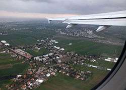
Tzafria (Hebrew: צַפְרִיָּה, Arabic: تسبارياه) is a religious moshav in central Israel. Located near Ben Gurion International Airport, it falls under the jurisdiction of Lod Valley Regional Council. In 2017 it had a population of 912.[1]
History
The village was founded in 1949 by immigrants from Czechoslovakia and Hungary on the land of the depopulated Palestinian village of al-Safiriyya.[2] Its name is derived from that village and was initially called Safria Alef and then Kfar Tzafria before adopting its current name.
References
| Wikimedia Commons has media related to Tzafria. |
- 1 2 "List of localities, in Alphabetical order" (PDF). Israel Central Bureau of Statistics. Retrieved August 26, 2018.
- ↑ Khalidi, Walid (1992). All That Remains:The Palestinian Villages Occupied and Depopulated by Israel in 1948. Washington D.C.: Institute for Palestine Studies. p. 253. ISBN 0-88728-224-5.
This article is issued from
Wikipedia.
The text is licensed under Creative Commons - Attribution - Sharealike.
Additional terms may apply for the media files.