Tyuleniy Archipelago (Kazakhstan)
| Kazakh: Түлен аралдары | |
|---|---|
 Islands of the Tyuleniy Archipelago | |
 Location of the Tyuleniy Archipelago in the Caspian Sea. | |
| Geography | |
| Location | Caspian Sea, |
| Coordinates | 44°55′N 50°22′E / 44.917°N 50.367°E |
| Area | 130 km2 (50 sq mi) |
| Highest elevation | 2 m (7 ft) |
| Administration | |
| Region | Mangystau Region |
| Demographics | |
| Population | 5 |
The Tyuleniy Archipelago, Kazakh: Түлен аралдары Tülen Araldary, Russian: Тюленьи острова is an island group in the north-eastern Caspian Sea located off the Mangyshlak Bay west of the Mangyshlak Peninsula and about 13 kilometres (8.1 miles) NW of the Tupkaragan Peninsula, 27 kilometres (17 miles) north of Bautino. Perhaps the most substantial group of islands in the Caspian, they were first accurately cartographed by Fedor Ivanovich Soimonov who led the 1719 Caspian Expedition, studying the Caspian Sea from 1719 to 1727.[1]
Administratively, the Tyuleniy Archipelago belongs to the Mangystau Region of Kazakhstan. It was named "Tyuleniy" —meaning "seal"— after the currently endangered Caspian seal.
Islands
- Kulaly Island (Kulaly-Aral) is the westernmost and longest island, stretching 25 km from tip to tip. Its shape is slightly irregular, with inlets and headlands. There is a meteorological station with a lighthouse and a Kazakh border guard post on this island, making it the only one in the group inhabited by man. The terrain on Kulaly is either arid or waterlogged and reed-covered.[2]
- Morskoy Island (Morskoy Aral) is the next island and the second largest island. It is also the biggest in area, with a length of 19 km and a maximum width of 7 km. This island consists mostly of wetland.
- Rybachy Island (formerly Ostrov Svyatoy) is long and narrow and is located south of Morskoy.
- Podgornyy Island is located NE of Rybachy.[3]
- Novyy Island is the easternmost island. It is located between Podgorny and the mainland and used to have an irregular shape until about 2009. Recent pictures show that this island has eroded heavily.[4]
Ecology
The islands are desert-like and sandy, with little grass. There are reeds on the leeward side of Kulaly as well as on the other islands, which are much lower and waterlogged. In past centuries many Caspian seals come to the islands' shores, hence the name of the group.
The islands have been declared an IBA and a National Protected Zone (State Reservation). There are large concentrations of seagulls and wetland birds, like coots, wild ducks, swans, egrets and waders, in the archipelago during their nesting period. The Tyuleniy island group is also an important breeding ground for the Sandwich tern (Sterna sandvicensis).
 NASA image of the archipelago and nearby shores. Note the size of Novyy Island. |
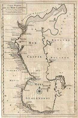 1721 Van Verden map of the Caspian Sea in which Kulaly is the only island of the archipelago that is named. |
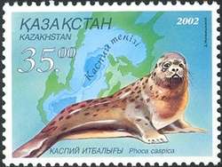 The archipelago is named after the Caspian seal (Pusa caspica) |
References
- ↑ Igor S. Zonn, Aleksey N Kosarev, Michael H. Glantz & Andrey G. Kostianoy, The Caspian Sea Encyclopedia
- ↑ Structures on Kulaly Island
- ↑ Podgornyy Island
- ↑ GoogleEarth
External links
- Geographic data
- Birdlife
- Caspian Sea Biodiversity Project
- Rowlett, Russ. "Lighthouses of Kazakhstan". The Lighthouse Directory. University of North Carolina at Chapel Hill.
|