Tyers, Victoria
| Tyers Victoria | |||||||||||||||
|---|---|---|---|---|---|---|---|---|---|---|---|---|---|---|---|
 Tyers | |||||||||||||||
| Coordinates | 38°09′S 146°28′E / 38.150°S 146.467°ECoordinates: 38°09′S 146°28′E / 38.150°S 146.467°E | ||||||||||||||
| Population | 824 (2016 census)[1] | ||||||||||||||
| Postcode(s) | 3844 | ||||||||||||||
| Location | |||||||||||||||
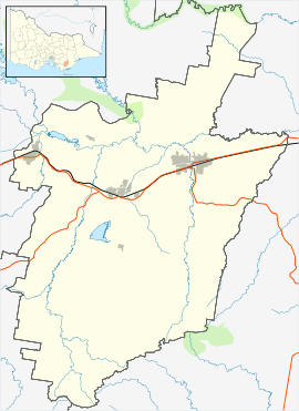
| LGA(s) | City of Latrobe | ||||||||||||||
| State electorate(s) | Morwell | ||||||||||||||
| Federal Division(s) | Gippsland | ||||||||||||||
| |||||||||||||||
Tyers is a small town in Victoria, Australia. It is 158 kilometres (98 mi) east of Melbourne, 10 kilometres (6 mi) north-west of Traralgon and located in the City of Latrobe. It was known until 1852 as "Boola Boola", after which it was named after the surveyor and explorer Charles Tyers. At the 2016 census, Tyers had a population of 824.[1]
Tyers Post Office opened on 11 September 1882 and is now owned by United Fuels.[2]
The town in conjunction with neighbouring Traralgon has an Australian Rules football team Traralgon-Tyers United competing in the North Gippsland Football League.
The Tyers Arts Festival is an annual event, held since 1979.
Features
- Tyers Lookout is on the Walhalla-Tyers Road (C481), two kilometres from the township on the left. It overlooks the Latrobe Valley.
- Peterson's Lookout is a short walk to the lookout overlooking the Tyers River Gorge, 6 km north of the Tyers township on Walhalla-Tyers Road (C481). This walk can also be started at the W2 track where there's signage and a trail. This is an extra 2 km (or 4 km return) walk, and is certified as a Heart Foundation Walk.
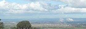
View from the 'Tyers Lookout'.
References
- 1 2 Australian Bureau of Statistics (27 June 2017). "Tyers (State Suburb)". 2016 Census QuickStats. Retrieved 31 January 2018.

- ↑ Premier Postal History, Post Office List, archived from the original on 2008-05-10, retrieved 2008-04-11
External links
- Tyers Arts Festival
- Peterson's Lookout walking map
This article is issued from
Wikipedia.
The text is licensed under Creative Commons - Attribution - Sharealike.
Additional terms may apply for the media files.