Two Mile Ash
| Two Mile Ash | |
|---|---|
 Two Mile Ash local centre. The High Street passes to either side of the shopping building. | |
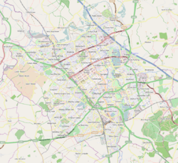 Two Mile Ash Mapping © OpenStreetMap 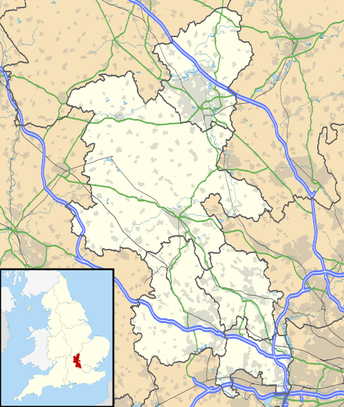 Two Mile Ash Two Mile Ash shown within Buckinghamshire | |
| OS grid reference | SP820386 |
| Civil parish |
|
| Unitary authority | |
| Ceremonial county | |
| Region | |
| Country | England |
| Sovereign state | United Kingdom |
| Post town | MILTON KEYNES |
| Postcode district | MK8 |
| Dialling code | 01908 |
| Police | Thames Valley |
| Fire | Buckinghamshire |
| Ambulance | South Central |
| EU Parliament | South East England |
| UK Parliament | |
Two Mile Ash is a district in north west Milton Keynes, two miles south of Stony Stratford, just off Watling Street. The district was named after the Two Mile Ash toll gate on Watling Street. It is one of the larger districts, but a large part of its area is taken up by Abbey Hill, an 18-hole golf course. Consequently, many of the streets here are named after famous golf courses. The district was one of the first to be built in the (mainly) private housing period of the development of Milton Keynes. It is in Bradwell civil parish.
The main spine of the area is The High Street with facilities running off it. Three other main roads are named Church Hill, Clay Hill and Corn Hill, all of which provide exits from the district. Fairways is another exit road, which lies near the Abbey Hill Golf Course. Two Mile Ash provides space for one half of this course, the other half is in neighbouring Kiln Farm, accessed by a foot bridge.
There is a lot of variety in the housing. There is a scheme of Findlandia super-insulated houses in Calewen and some very distinctive shared ownership homes in the High Street. It has two schools (Two Mile Ash Middle School and Ashbrook First School), two pre-schools (Two Mile Ash Pre-school and Helping Hands) and it also has three churches.
Place name
The name is shown on a map dated 1559 as "Mile Ash" as a tree on a mound with Watling Street passing either side. During the early 17th century, the section of Watling Street between Hockliffe and Dunchurch (and thus serving this neighborhood) became a turnpike. A toll-gate, the "Twomile Ash Toll Gate" was located here, and it was from this that Milton Keynes Development Corporation took the district name.[1] By the First Edition of the Ordnance Survey (1846-), a building is shown beside the road, called "Twomile Ash".
A milestone can still be found on Watling Street (now called the V4). Immediately behind the two mile post are three Ash trees planted by Milton Keynes Parks Trust. This section of Watling Street was the original A5 road until the route was diverted to become the eastern boundary of the district.
Other historical interest
A Romano-British farmstead was discovered and excavated on the northern edge of the golf course (near the Friendly Lodge Hotel on Monks Way).[2] The district was originally in the lands of Bradwell Abbey [3] and is now in the modern Civil Parish of the same name.