Turner, Oregon
| Turner, Oregon | |
|---|---|
| City | |
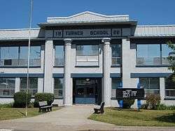 Turner School | |
| Motto(s): The Good Neighbor Town | |
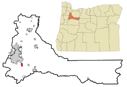 Location in Oregon | |
| Coordinates: 44°50′45″N 122°57′10″W / 44.84583°N 122.95278°WCoordinates: 44°50′45″N 122°57′10″W / 44.84583°N 122.95278°W | |
| Country | United States |
| State | Oregon |
| County | Marion |
| Incorporated | 1905 |
| Government | |
| • Mayor | Gary Tiffin |
| Area[1] | |
| • Total | 1.45 sq mi (3.76 km2) |
| • Land | 1.43 sq mi (3.70 km2) |
| • Water | 0.02 sq mi (0.05 km2) |
| Elevation | 287 ft (87 m) |
| Population (2010)[2] | |
| • Total | 1,854 |
| • Estimate (2012[3]) | 1,887 |
| • Density | 1,296.5/sq mi (500.6/km2) |
| Time zone | UTC-8 (Pacific) |
| • Summer (DST) | UTC-7 (Pacific) |
| ZIP codes | 97359, 97392 |
| Area code(s) | 503 |
| FIPS code | 41-75150[2] |
| GNIS feature ID | 1136845[4] |
| Website | http://www.cityofturner.org/ |
Turner is a city in Marion County, Oregon, United States. The population was 1,854 at the 2010 census. It is part of the Salem Metropolitan Statistical Area. The community was incorporated by the Oregon Legislative Assembly on February 10, 1905.[5]
Geography
According to the United States Census Bureau, the city has a total area of 1.45 square miles (3.76 km2), of which, 1.43 square miles (3.70 km2) is land and 0.02 square miles (0.05 km2) is water.[1]
Demographics
| Historical population | |||
|---|---|---|---|
| Census | Pop. | %± | |
| 1880 | 85 | — | |
| 1910 | 191 | — | |
| 1920 | 289 | 51.3% | |
| 1930 | 283 | −2.1% | |
| 1940 | 414 | 46.3% | |
| 1950 | 610 | 47.3% | |
| 1960 | 770 | 26.2% | |
| 1970 | 846 | 9.9% | |
| 1980 | 1,116 | 31.9% | |
| 1990 | 1,281 | 14.8% | |
| 2000 | 1,199 | −6.4% | |
| 2010 | 1,854 | 54.6% | |
| Est. 2016 | 2,031 | [6] | 9.5% |
| U.S. Decennial Census[7] | |||
2010 census
As of the census of 2010, there were 1,854 people, 710 households, and 513 families residing in the city. The population density was 1,296.5 inhabitants per square mile (500.6/km2). There were 768 housing units at an average density of 537.1 per square mile (207.4/km2). The racial makeup of the city was 93.2% White, 0.6% African American, 1.7% Native American, 0.5% Asian, 2.0% from other races, and 2.0% from two or more races. Hispanic or Latino of any race were 7.3% of the population.[2]
There were 710 households of which 33.1% had children under the age of 18 living with them, 57.6% were married couples living together, 8.9% had a female householder with no husband present, 5.8% had a male householder with no wife present, and 27.7% were non-families. 23.5% of all households were made up of individuals and 15.3% had someone living alone who was 65 years of age or older. The average household size was 2.61 and the average family size was 3.07.[2]
The median age in the city was 39 years. 25.5% of residents were under the age of 18; 7.1% were between the ages of 18 and 24; 24.8% were from 25 to 44; 24.4% were from 45 to 64; and 18.3% were 65 years of age or older. The gender makeup of the city was 48.1% male and 51.9% female.[2]
2000 census
As of the census of 2000, there were 1,199 people, 491 households, and 330 families residing in the city. The population density was 778.0 people per square mile (300.6/km²). There were 522 housing units at an average density of 338.7 per square mile (130.9/km²). The racial makeup of the city was 93.83% White, 0.08% African American, 1.67% Native American, 0.25% Asian, 2.00% from other races, and 2.17% from two or more races. Hispanic or Latino of any race were 4.34% of the population.[2]
There were 491 households out of which 27.1% had children under the age of 18 living with them, 56.8% were married couples living together, 7.1% had a female householder with no husband present, and 32.6% were non-families. 27.5% of all households were made up of individuals and 20.0% had someone living alone who was 65 years of age or older. The average household size was 2.44 and the average family size was 2.99.[2]
In the city, the population was spread out with 23.8% under the age of 18, 7.4% from 18 to 24, 24.3% from 25 to 44, 22.4% from 45 to 64, and 22.1% who were 65 years of age or older. The median age was 41 years. For every 100 females, there were 92.8 males. For every 100 females age 18 and over, there were 88.5 males.[2]
The median income for a household in the city was $36,250, and the median income for a family was $43,906. Males had a median income of $38,125 versus $23,636 for females. The per capita income for the city was $26,234. About 4.8% of families and 9.2% of the population were below the poverty line, including 9.8% of those under age 18 and 7.3% of those age 65 or over.[2]
Notable people
- Dean Cromwell (1879–1962), U.S. Olympic track and field coach, USC track and football coach
See also
References
- 1 2 "US Gazetteer files 2010". United States Census Bureau. Archived from the original on 2012-01-24. Retrieved 2012-12-21.
- 1 2 3 4 5 6 7 8 9 "American FactFinder". United States Census Bureau. Retrieved 2012-12-21.
- ↑ "Population Estimates". United States Census Bureau. Archived from the original on 2013-06-17. Retrieved 2013-06-02.
- ↑ "US Board on Geographic Names". United States Geological Survey. 2007-10-25. Retrieved 2008-01-31.
- ↑ Whitney, J. R. (1905). "The Special Laws of the State of Oregon Enacted by The Twenty-third Legislative Assembly Regular Session". Salem, Oregon: State Printer: 155.
- ↑ "Population and Housing Unit Estimates". Retrieved June 9, 2017.
- ↑ "Census of Population and Housing". Census.gov. Retrieved June 4, 2015.
External links

- Entry for Turner in the Oregon Blue Book
Municipalities and communities of Marion County, Oregon, United States | ||
|---|---|---|
| Cities | 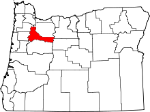 | |
| CDPs | ||
| Unincorporated communities | ||
| Ghost towns | ||
| Indian reservation | ||
| Footnotes | ‡This populated place also has portions in an adjacent county or counties | |