Turbaco
| Turbaco | ||
|---|---|---|
| Municipality and town | ||
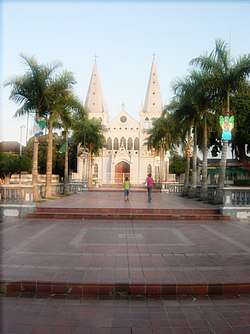
 Turbaco Plaza, Church of Santa Catalina. | ||
| ||
| Nickname(s): Los Tira Piedra | ||
 Location of the municipality and town of Turbaco in the Bolívar Department of Colombia | ||
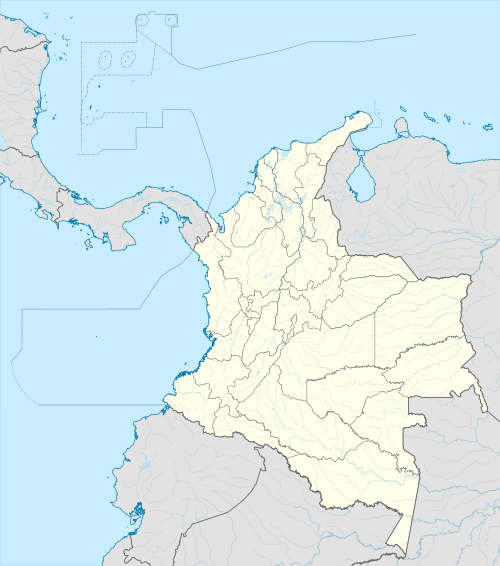
 Turbaco Location in Colombia | ||
| Coordinates: 10°19′N 75°26′W / 10.317°N 75.433°W | ||
| Country |
| |
| Department | Bolívar Department | |
| Government | ||
| • Mayor | Mayron Martinez | |
| Area | ||
| • Total | 170 km2 (70 sq mi) | |
| Elevation | 128 m (420 ft) | |
| Population (2012) | ||
| • Total | 69,099 | |
| • Density | 410/km2 (1,100/sq mi) | |
| Demonym(s) | Turbaquero | |
| Time zone | UTC-5 (Colombia Standard Time) | |
| Area code(s) | 57 + 5 | |
| Website | Official website (in Spanish) | |
Turbaco is a municipality in the Bolívar Department of Colombia. It is about 20 minutes from Cartagena de Indias and is one of Bolívar's most organized municipalities. Turbaco is known for its famous "Fiesta de Toros" (Bulls's feast) in December to celebrate the new year. Currently, the municipality is undergoing major expansion plans and remodeling.
Juan de la Cosa was mortally wounded here in 1510, before Pedro de Heredia subjugated the area in 1533.[1][2] Antonio López de Santa Anna spent some of his exile years here, 1850-1853 and 1855-1857.[3]
References
- ↑ Parry, John; Keith, Robert (1984). New Iberian World: A Documentary History of the Discovery and Settlement of Latin America to the Early 17th Century, Vol. II. New York: Times Books. p. 454,479–485. ISBN 9780812910704.
- ↑ Floyd, Troy (1973). The Columbus Dynasty in the Caribbean, 1492-1526. Albuquerque: University of New Mexico Press. pp. 49, 89, 95, 135.
- ↑ Lemaitre, Eduardo (1994). A Brief History of Cartagena. Medellin: Compania Litografica Nacional S.A. p. 13,75. ISBN 9789586380928.
Coordinates: 10°21′N 75°20′W / 10.350°N 75.333°W
This article is issued from
Wikipedia.
The text is licensed under Creative Commons - Attribution - Sharealike.
Additional terms may apply for the media files.
.svg.png)