Tulare Hill
| Tulare Hill | |
|---|---|
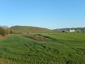 Tulare Hill along Santa Teresa Boulevard | |
| Highest point | |
| Elevation | 620 ft (190 m) NGVD 29[1] |
| Coordinates | 37°13′16″N 121°45′18″W / 37.2210554°N 121.7549494°WCoordinates: 37°13′16″N 121°45′18″W / 37.2210554°N 121.7549494°W [2] |
| Geography | |
 Tulare Hill Location in California | |
| Location | Santa Clara County, California, U.S. |
| Parent range | Santa Teresa Hills |
| Topo map | USGS Tulare Hill |
Tulare Hill is a prominent hill in the Santa Teresa Hills of western Santa Clara County, California. It lies along the southernmost edge of San Jose, California, adjacent to the Metcalf Energy Center. The hill and surrounding 330 acres (130 ha) of serpentine grasslands are home to the endangered Bay checkerspot butterfly[3] and Dudleya setchellii wildflower.[4]
See also
References
- ↑ "Tulare Hill". ListsOfJohn.com. Retrieved 2014-03-08.
- ↑ "Tulare Hill". Geographic Names Information System. United States Geological Survey. Retrieved 2013-04-24.
- ↑ PG&E Newsletter, March 2013
- ↑ Silicon Valley Land Conservancy Newsletter, Summer 2008
This article is issued from
Wikipedia.
The text is licensed under Creative Commons - Attribution - Sharealike.
Additional terms may apply for the media files.