Zalambessa
| Zalambessa ዛላኣንበሳ | ||
|---|---|---|
| ||
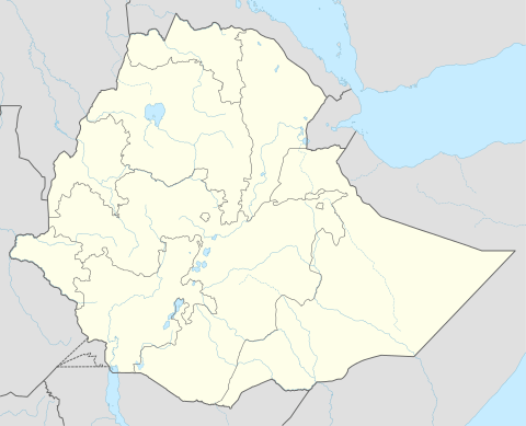
 Zalambessa Location | ||
| Coordinates: 14°31′33″N 39°23′9″E / 14.52583°N 39.38583°ECoordinates: 14°31′33″N 39°23′9″E / 14.52583°N 39.38583°E | ||
| Country | Ethiopia | |
| Region | Tigray | |
| Zone | Misraqawi (Eastern) | |
| Woreda | Ahferom | |
| Population (2005) | ||
| • Total | 10,551 | |
| Time zone | UTC+03:00 | |
Zalambessa (Ge'ez: ዛላአንበሳ) is a town located on the Ethiopian border. Zalambessa is part of the Misraqawi (Eastern) Zone of the Tigray Region. It is about 42 kilometers north of Adigrat. The Serha-Zalambesa border crossing is located in the town.
History
Origins
Zalambessa was a village that was fortified by Italian colonial forces.
20th Century
The fortifications were taken over by the Ethiopian military in 1952 when Eritrea was federated with Ethiopia. The older village (Tsorona) remained under Eritrean Administration and the exact border became an issue before and during the Eritrean-Ethiopian War (1998–2000).[1] After the war, the town was in ruins.[2]
21st Century
In 2000, Eritrea and Ethiopia signed the Algiers Agreement (2000) which forwarded the border dispute to a Hague boundary commission. In the Agreement both parties agreed in advance to comply with the ruling of the Border Commission. In 2002, the commission ruling, reconfirmed and made more precise in their final ruling effective November 2007, placed Tsorona inside Eritrean territory, and Zalambessa inside Ethiopian territory.
According to the Eritrean Information Ministry, Ethiopian Forces crossed the border early on New Years Day 2010, and engaged in a fierce battle with Eritrean troops before quickly withdrawing back over the border, after having 10 soldiers killed and 2 taken prisoner. Ethiopian government spokesman Bereket Simon denied that any armed incursion had taken place.[3]
Economy
Kuwaiti Prime Minister Sheikh Nasser Mohammed Al-Ahmed Al-Sabah announced in July 2009, during a 3-day visit to Ethiopia, that his country would provide a $63 million loan to Ethiopia, part of which would be used to build a road between Wukro and Zalambessa.[4]
On 11 September 2018, the Serha-Zalambesa border crossing border crossing of Eritrea-Ethiopia border reopens for the first time since 1998.[5]
Demographics
Based on figures from Ethiopia the Central Statistical Agency of Ethiopia released in 2005, Zalambessa has an estimated total population of 10,551, of whom 5,176 are men and 5,375 are women.[6] The 1994 census reported it had a total population of 6,059 of whom 2,756 were males and 3,303 were females. It is not clear whether these census figures cover the entire area.
Economy
The Commercial Bank of Ethiopia re-opened its Zalambessa Branch in on 12 February, 2009.[7] The branch had been closed for ten years following the invasion by Eritrean Government. This reopening is crucial in supporting the economic and social activities in the area.
References
- ↑ Killion, Tom (1998). Historical Dictionary of Eritrea. ISBN 0-8108-3437-5.
- ↑ Last, Alex (26 May 2000). "Eritrea's 'tactical retreat'". BBC News. Retrieved 9 July 2017.
- ↑ "Eritrea says 10 Ethiopian troop killed". Television New Zealand. Reuters. 4 January 2010. Retrieved 25 November 2011.
- ↑ "Kuwait Loans Ethiopia EUR45 Million For Electricity, Roads - Report", Addis Live website, 21 July 2009 (accessed 19 August 2009)
- ↑ Ahmed, Hadra (11 September 2018). "Ethiopia-Eritrea Border Opens for First Time in 20 Years". The New York Times. Retrieved 13 September 2018.
- ↑ CSA 2005 National Statistics, Table B.4
- ↑ "CBE has opened its 206th branch and reopened its Zala-Anbessa Branch". ENP Newswire. 30 April 2009.
