Tsiombe
| Tsiombe | |
|---|---|
| town | |
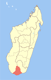
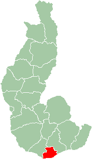 Map of former Toliara Province showing the location of Tsiombe (red). | |
| Coordinates: 25°18′S 45°29′E / 25.300°S 45.483°E | |
| Country | Madagascar |
| Region | Androy |
| District | Tsiombe |
| Elevation | 150 m (490 ft) |
| Time zone | UTC3 (EAT) |
Tsiombe is a town in Androy Region, Madagascar. It is situated at the Manambovo River and the Route nationale 10 and about 30 km north of the southernmost point of the island, Cape Sainte Marie.
Although the majority of the population are primarily adherents of Christianity and traditional beliefs, Tsiombe is the only town in the Androy region of Madagascar that has a mosque and a permanent Imam, although tensions between religious communities are low.[1]
References
- ↑ Charrouf, Ismael (July 31, 2018). "Facing North". Peace Corps. Retrieved August 21, 2018.
This article is issued from
Wikipedia.
The text is licensed under Creative Commons - Attribution - Sharealike.
Additional terms may apply for the media files.