Tsauchab
The Tsauchab is an ephemeral stream in Namibia, in the southern Naukluft Mountains. It is approximately 100 km (62 mi) long, and known especially for the portion in which it flows through the Sesriem Canyon.
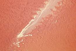
Since it is in the Namib Desert, the Tsauchab carries water only during the rare times when rain falls in the Naukluft Mountains and runs off, since it cannot seep into the soil fast enough (see flash flood). During these rains, the Tsauchab becomes a rapid-running, strong river within a matter of hours.
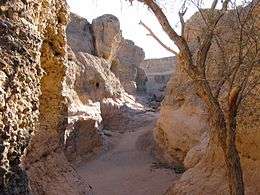
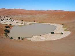
As a result of the occasional rains, it has over the past two million years carved the Sesriem Canyon, a kilometer (0.6 mile) long and up to 30-meter (100-foot) deep canyon in sedimentary rock. Past the canyon, the Tsauchab flattens and grows broader, and is surrounded by a riparian forest as it slopes towards the Sossusvlei salt pan. In the Sossusvlei area, the riparian forest consists of both the living trees including Maerua crassifolia and the remaining skeletons of dead trees.[1]
External links
References
- ↑ "The photographs of the Tsauchab river which were made at the following geo coordinates: 24°38'42.6"S 15°39'06.9"E". Independent Travellers. independent-travellers.com. Retrieved January 9, 2018.