Trout Lake (Ontario)
| Trout Lake | |
| Lake | |
| Country | Canada |
|---|---|
| Province | Ontario |
| Region | Northeastern Ontario |
| District | Nipissing |
| Municipalities | East Ferris, North Bay |
| Part of | Ottawa River drainage basin |
| Elevation | 202 m (663 ft) |
| Coordinates | 46°18′52″N 79°19′27″W / 46.31444°N 79.32417°WCoordinates: 46°18′52″N 79°19′27″W / 46.31444°N 79.32417°W |
| Mouth | Mattawa River |
| - coordinates | 46°18′22″N 79°14′01″W / 46.30611°N 79.23361°W |
| Length | 11 km (7 mi) |
| Width | 4 km (2 mi) |
| Shoreline1 | 52 km (32 mi) |
| Islands | 25 |
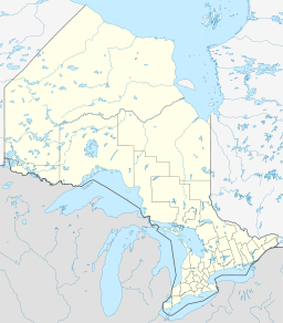
 Location of Trout Lake in Ontario. | |
| 1. Shoreline is a poorly defined measure | |
Trout Lake is a lake in municipalities of East Ferris and North Bay, Nipissing District in Northeastern Ontario, Canada, approximately 6 kilometres (4 mi) east of the much larger Lake Nipissing. Trout Lake is the source of the Mattawa River and a significant body of water on a well-known historic North American voyageur (fur-trading) route. It is about 11 kilometres (7 mi) long and 4 kilometres (2 mi) wide and exits eastward into the Mattawa River, which flows via the Ottawa River to the St. Lawrence River. Some of the most difficult portages are found on this part of the voyageur route between Trout Lake and the end of the Mattawa River, e.g., Portage de Mauvaise Musique, located at the Talon Chute (named after explorer and voyageur Jean Talon).
Water reservoir
The City of North Bay (population approx 54,000) draws its drinking water from Trout Lake. While the urban core of North Bay is located primarily between Trout Lake and Lake Nipissing, the city limits contain the lake's entire northern shore. Much of the lake's southern shore is located within the township of East Ferris.
Seaplane Base
North Bay Water Aerodrome (CNH7) is a seaplane base located near the western end of the lake.[1]
Campbell disappearance
In October 2006, a long-time unsolved mystery of a couple who disappeared from their Trout Lake cabin in the spring of 1956 was solved. Margaret and Allen Campbell, along with their family dog, went missing on May 25, 1956 under mysterious conditions. It was believed that Mr. and Mrs. Campbell went out in their fibreglass boat from the shore, encountered trouble and presumably drowned, but search teams in 1956 were unable to find their bodies or their boat. This mystery also amplified the belief in the cryptozoological legend of the Trout Lake Monster. In 2006, the Ontario Provincial Police, on a lead from a recreational fisherman and using high-tech imaging equipment, discovered both bodies on the bottom of the lake, not far from the couple's cabin. Their boat was also found nearby on the bottom of the lake. The Campbell's surviving children were very relieved to have the mystery of their missing parents finally solved.[2]
Bays
- Delaney Bay
- Dugas Bay
- Four Mile Bay
- Milnes Bay
- One Mile Bay
Islands
- Camp Island
- Cedar Island
- Dave Island
- Dellview Island
- Dunn Island
- Falconbridge Island
- Fitzsimmons Island
- Hemlock Island
- Hughes Island
- Joe Island
- Little Joe Island
- Louisville Island
- Murdoch Island
- Payne Island
- Poplar Island
- Rolph Island
- Shaftesbury Island
- Three Sisters Islands
- Trout Island
Tributaries
- Doran Creek
- Four Mile Creek
- Hogan Creek
- Lees Creek
See also
References
- "Trout Lake". Geographical Names Data Base. Natural Resources Canada. Retrieved 2011-02-23.
- "Topographic Map sheet 31L6". Atlas of Canada. Natural Resources Canada. 2010-02-04. Retrieved 2011-02-23.