Troarn
| Troarn | ||
|---|---|---|
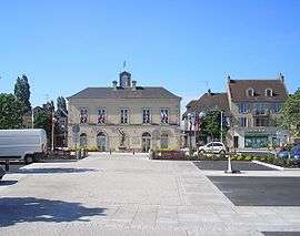 Paul Quellec Square | ||
| ||
 Troarn Location within Normandy region  Troarn | ||
| Coordinates: 49°10′56″N 0°11′00″W / 49.1822°N 0.1833°WCoordinates: 49°10′56″N 0°11′00″W / 49.1822°N 0.1833°W | ||
| Country | France | |
| Region | Normandy | |
| Department | Calvados | |
| Arrondissement | Caen | |
| Canton | Troarn | |
| Area1 | 11.53 km2 (4.45 sq mi) | |
| Population (2008)2 | 3,717 | |
| • Density | 320/km2 (830/sq mi) | |
| Time zone | UTC+1 (CET) | |
| • Summer (DST) | UTC+2 (CEST) | |
| INSEE/Postal code | 14712 /14670 | |
| Elevation |
2–61 m (6.6–200.1 ft) (avg. 36 m or 118 ft) | |
|
1 French Land Register data, which excludes lakes, ponds, glaciers > 1 km2 (0.386 sq mi or 247 acres) and river estuaries. 2 Population without double counting: residents of multiple communes (e.g., students and military personnel) only counted once. | ||

Troarn is a former commune in the Calvados in the Normandy region in northwestern France. On 1 January 2017, it was merged into the new commune Saline.[1]
Population
| Historical population | ||
|---|---|---|
| Year | Pop. | ±% |
| 1962 | 1,137 | — |
| 1968 | 1,375 | +20.9% |
| 1975 | 1,975 | +43.6% |
| 1982 | 3,011 | +52.5% |
| 1990 | 3,129 | +3.9% |
| 1999 | 3,176 | +1.5% |
| 2008 | 3,717 | +17.0% |
Sights
- The abbey founded by Roger de Montgomery in 1059
See also
References
- ↑ Arrêté préfectoral 29 July 2016 (in French)
| Wikimedia Commons has media related to Troarn. |
This article is issued from
Wikipedia.
The text is licensed under Creative Commons - Attribution - Sharealike.
Additional terms may apply for the media files.