Tretzevents (Canigó)
| Tretzevents | |
|---|---|
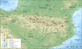 Tretzevents Location in the Pyrenees | |
| Highest point | |
| Elevation | 2,731 m (8,960 ft) |
| Coordinates | 42°29′30″N 2°28′08″E / 42.49167°N 2.46889°ECoordinates: 42°29′30″N 2°28′08″E / 42.49167°N 2.46889°E |
| Geography | |
| Location | Vallespir, Catalonia |
| Parent range | Pyrenees |
Tretzevents or Puig de Tres Vents[1] is a mountain of the Canigó Massif, Pyrenees, Catalonia, France. Located between the communes of Cortsaví (Corsavy) and El Tec (Le Tech), Pyrénées-Orientales, it has an elevation of 2,731 metres above sea level.[2] A secondary 2,727 m high summit is located at the limit of the Castell de Vernet (Casteil) commune.[3]
See also
- Canigó (Canigou)
- Mountains of Catalonia
References
- ↑ Institut d'Estudis Catalans
- ↑ "Mapa Topogràfic de Catalunya". Institut Cartogràfic de Catalunya. Retrieved May 22, 2010. .
- ↑ IGN Maps Geoportail(in French)
This article is issued from
Wikipedia.
The text is licensed under Creative Commons - Attribution - Sharealike.
Additional terms may apply for the media files.