Treptow
| Sign | Map |
|---|---|
 |
 |
| Area: | 40.65 km² |
| Inhabitants: | 113,140 (1999) |
| Population density: | 2783 inhabitants per km² |
| Politics | |
| Status: | Disestablished as borough with the 2001 administrative reform |
| Last mayor: | Siegfried Stock (SPD) |
Treptow (German pronunciation: [ˈtʁeːptoː]) is a former borough in the southeast of Berlin. It merged with Köpenick to form Treptow-Köpenick in 2001.
Geography
The district was composed by the localities of Alt-Treptow, Plänterwald, Baumschulenweg, Niederschöneweide, Johannisthal, Adlershof, Altglienicke and Bohnsdorf.
Photo gallery
 Twin Towers building in Treptow
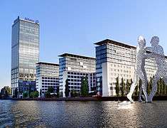 Treptowers compound in Treptow
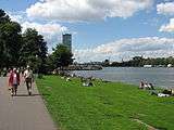 People sunbathing along the Spree River in Treptow
See also
External links
| West boroughs (1920–2000) | 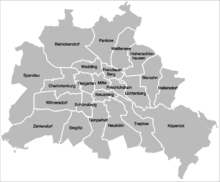 | |
|---|---|---|
| East boroughs (1920–2000) |
| |
Coordinates: 52°29′03″N 13°28′46″E / 52.48417°N 13.47944°E
This article is issued from
Wikipedia.
The text is licensed under Creative Commons - Attribution - Sharealike.
Additional terms may apply for the media files.